<?xml version="1.0" encoding="UTF-8"?>
<feed xmlns="http://www.w3.org/2005/Atom">
  <title type="text">Cleveland Historical</title>
  <updated>2026-04-17T12:26:30+00:00</updated>
  <generator uri="http://framework.zend.com" version="1.12.20">Zend_Feed_Writer</generator>
  <link rel="alternate" type="text/html" href="https://clevelandhistorical.org/"/>
  <link rel="self" type="application/atom+xml" href="https://clevelandhistorical.org/items/browse?output=rss2"/>
  <id>https://clevelandhistorical.org/</id>
  <author>
    <name>Cleveland Historical</name>
    <uri>https://clevelandhistorical.org</uri>
  </author>
  <link rel="hub" href="http://pubsubhubbub.appspot.com/"/>
  <entry>
    <title type="html"><![CDATA[Corning House: The Last Surviving Vestige of Cranwood  Farm and Race Track]]></title>
    <summary type="html"><![CDATA[<p><strong><em>Warren Corning worked in the distillery business for 30 years, building a very successful company with offices and other facilities in both Cleveland and Peoria, Illinois.  In the early 1880s, perhaps in anticipation of selling and retiring from that business, he purchased more than 200 acres of land in rural Newburgh Township (today, part of the Cleveland suburb of Garfield Heights), creating upon that land a horse and cattle farm which he called "Cranwood."</em></strong></p><img src="https://clevelandhistorical.org/files/fullsize/29ae01444341edcfd43a704983683751.jpg" alt="Corning House in Garfield Heights" /><br/><p>If you happen to find yourself one day driving down East 131st Street in the Garfield Heights Cranwood neighborhood, you may wish to take note of the multi-family brick dwelling on the northwest corner of East 131st and Christine Avenue. Known in that suburb as the Corning House, it is the last remnant of both a wealthy 19th century Clevelander's cattle and horse farm and, as well, a popular early twentieth century horse race track. The story of how this farm and race track fit into the history of this Cleveland suburb begins with Warren Corning.</p><p>Warren Holmes Corning was born in Painesville, Ohio, in 1841. In 1857, his family moved to Cleveland, and, as a sixteen year old, he entered into the distillery business, successfully working his way up from the bottom to ownership of a very profitable company. In 1887, Corning sold his company and retired from that business, becoming an investor in and officer of several large Cleveland banks, including First National Bank and Guardian Trust Company. In 1893, the Corning family moved from their house on Prospect Avenue into one of Euclid Avenue's grand mansions, built in 1874 for wealthy Cleveland banker, <a href="https://clevelandhistorical.org/items/show/817">Daniel Eells</a>. While no longer standing, it once stood on the north side of Euclid Avenue, just east of East 30th Street, next door to the founder of the Otis Steel Company, and only three doors down from the mansion of Samuel Andrews, one of John D. Rockefeller's original partners. </p><p>
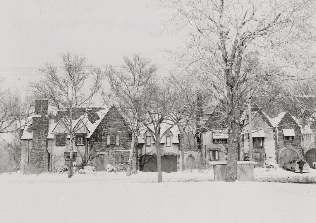
In 1883, Corning began purchasing land off Windfall Road (today, East 131st Street), between Miles and Broadway Avenues, in what was then Newburgh and Warrensville Townships, eventually assembling more than 200 acres of land. (Today, that land lies in the northeast part of the Cleveland suburb of Garfield Heights.) In 1884, Corning built a large house on land that fronted on Windfall Road. The house was designed, according to local architectural historian Craig Bobby, in the Queen Anne style, but it was an "understated" version of that style, then considered more suitable for a country residence. In its original design, the two and one-half story brick house featured asymmetrical massing, gabled roofs and a covered porch which extended across the entire front of the house. The interior of the house had, and still does today, approximately 8,000 square feet of living space. </p><p>According to the Garfield Heights Historical Society, Corning named the cattle and horse farm he developed on this land "Cranwood," a word that referred to both the cranberry bushes that grew wild on the land and the woods that were also prevalent there. An article appearing in the Plain Dealer on February 18, 1911, suggested another possible explanation--that the farm was named after one of Warren Corning's prize stallions. Whatever the name's origin, Corning took the business of his "horse nursery" very seriously and he soon built a small trotting track on land just across Windfall Road from his house. That track—no longer standing—would today be located east of East 131st Street, and between Thornhurst and Rexwood Avenues. Cleveland newspapers made regular mention of Cranwood Farm in the late 1880s as one of Cuyahoga County's several popular venues for harness (trotting) races. </p><p>Unfortunately for Warren Corning, his "retirement" life of raising cattle and nursing trotting horses on Cranwood Farm did not last long. In 1894, while undergoing an operation to remove cartilage from one of his knees, he developed "blood poisoning," which resulted in the amputation of a leg and eventually his premature death in 1899 at the age of 58. </p><p>By 1904, according to newspapers, Standard Land Company, a corporation owned by his heirs, was leasing the Corning house, and planning to redevelop the rest of his farm as a residential subdivision. Just seven years later in 1911, however, much of the redevelopment plan was put on hold when Standard Land Company leased the Cranwood Farm lands, including the Corning house and the trotting track across the street, to Alvin Pennock, who had formerly worked for Warren Corning at Cranwood Farm as a horse trainer.</p><p>In 1911, Pennock opened Cranwood Race Track for harness racing, enlarging the track created during Warren Corning's ownership and converting the Corning house into a race track clubhouse which featured a large restaurant and bar with seating for 150 people.  For a time, the restaurant was managed by Frank Bartek, whose parents were immigrants from Bohemia (today, part of the Czech Republic). According to local newspaper articles, the upstairs of the house was, during this period, separately leased to wealthy horse owners and their families as living quarters during the racing season. </p><p>In June 1914, a fire at Cranwood Race Track damaged the Club House, but Alvin Pennock was able to repair and reopen it in time for the Fall racing season. In that same year, Pennock added the new sport of automobile racing to the calendar of events held at the track. While Cranwood was a popular and very accessible race track, harness and auto racing did not last even a decade at the East 131st street location.</p><p>In 1922, Cranwood Race Track moved to a new and larger facility on Miles Avenue in Warrensville Heights, midway between Lee and Warrensville Center Roads. In 1959, the Miles Avenue race track closed when the land upon which it stood was targeted for industrial development. Edward J. DeBartolo purchased the Cranwood franchise, but then terminated it and transferred its racing dates to the calendar of Thistledown Race Track in North Randall. </p><p>Even before Cranwood Race Track moved to Miles Avenue, the Corning House appears to have ceased being used as a clubhouse. Alvin Pennock, who had acquired title to the house in 1915 from Standard Land Company, sold it in 1920 to the William and Louise Enslen family, who moved into it that year and, according to local directories, soon redeveloped the house into a multi-family dwelling. Changes to the exterior of the building included a major redesign of the front porch which at one time extended across the entire front facade of the house, replacing that original porch with several smaller porches located at three separate entrances to units of the multi-family dwelling. By the time the 1930 federal census was taken, there were four families residing in the house. In 1935, the former clubhouse building was again damaged in a fire, but once again it was repaired. By the time the 1940 census was taken, the number of families residing in separate units in the Corning House had increased to five. A decade later, the 1950 census listed six families living in the house. </p><p>Members of the Enslen family continued to own, live in and lease out rental units in the Corning House until 1976, when Clarence Enslen, the last of William and Louise Enslen's surviving children, sold it and moved to Parma. As of 2024, the Corning House was still being utilized as a multi-family dwelling. While Cranwood Farm and Cranwood Race Track are long gone from Garfield Heights, their names live on in the northeast section of that suburb which has been known as the Cranwood neighborhood. The neighborhood also has had an elementary school and a street titled with that locally historic name, but the only true surviving vestige of Warren Corning's farm and Alvin Pennock's race track in this suburb is the Corning House.</p><p><em><strong><a href="https://clevelandhistorical.org/items/show/1015">For more (including 11 images) view the original article</a></strong></em></p>]]></summary>
    <published>2024-02-21T03:31:39+00:00</published>
    <updated>2026-03-04T21:32:05+00:00</updated>
    <link rel="alternate" type="text/html" href="https://clevelandhistorical.org/items/show/1015"/>
    <id>https://clevelandhistorical.org/items/show/1015</id>
    <author>
      <name>Jim Dubelko</name>
    </author>
  </entry>
  <entry>
    <title type="html"><![CDATA[Fairhill Road Village: A Unique Planned Community ]]></title>
    <summary type="html"><![CDATA[<p><strong><em>"It is seldom that an entire neighborhood packs its trunks and moves in a body," wrote <em>The Architectural Exhibitor</em> in April of 1929 about a group of neighbors living around Hessler Road. The enclave of creative professionals planned to move into a community of their design, giving way to a historic development that bridges Cleveland and Cleveland Heights and urban and suburban living.</em></strong></p><img src="https://clevelandhistorical.org/files/fullsize/9caad50fe9b6e3d9b87b5fbdb316811b.jpg" alt="Fairhill Road Village" /><br/><p>Locally known as Belgian Village, Fairhill Road Village was listed on the National Register of Historic Places in 1990. Originally called Fairmount Place before the change of the development’s frontage road's name from Fairmount Road to Fairhill Road, the single-family homes combine detached and semi-detached dwellings. Today, thirteen homes comprise the Fairhill Road Village Historic District; five two-family semi-detached units built over the winter between 1929 and 1930 and three detached homes built intermittently in 1930, 1933, and 1971.
Fairhill recalls other planned communities built around the same time, notably Mayfair Lane in Buffalo, Sessions Village in Columbus, and the French Village in Philadelphia. All share the use of uniform architecture in a historic-revival style and semi-detached layout. Fairhill’s use of an unusually natural setting so close to an urban center allows it to be an exemplary model of this mode of building.</p><p>Standing on the abandoned debris created in the 1915 construction of the Fairmount Reservoir, Fairhill literally straddles the divide between urban and suburban by being built over the municipal boundary between Cleveland and Cleveland Heights. Architecturally Fairhill blends into its neighboring communities through historical revival architecture that evokes a common European heritage, a facet of suburban living. The development utilizes a style reflective of the Cotswold Hills District of England. The homes favor white varied stone and stucco with multiple gables and various recesses in the façade, creating the overall effect of an English hamlet appearing out of the forest.</p><p>The combination of shared and private space is central to Fairhill’s makeup. Originally planned as seventeen semi-detached homes by architect Antonio DiNardo, the eleven houses share a single drive with the dwellings facing a private park directly off Fairhill Road for shared use of the residents. The semi-detached units connect via their respective garages while service rooms above allow a more insular living space that looks onto private terraced gardens built at the edge of a ravine running through Ambler Park.</p><p>Landscape architect A. Donald Gray drove Fairhill’s development from conception to completion. Before moving to Cleveland, in 1920, Gray worked for The Olmsted Brothers landscape architecture firm under Frederick Law Olmsted Jr. Gray’s profession and his connections to the lauded firm show throughout Fairhill’s design.</p><p>The use of gardening to accentuate a site’s beauty and create natural boundaries was a key principle in Olmsted’s work and reflects in Fairhill’s balanced relationship between architecture and landscape. Each private terrace uses flower beds sparingly in order not to distract attention from the natural landscape. Decorative pools mirror the Doan Brook at the bottom of the ravine while simultaneously attracting birds into the garden. The additional planting of trees and shrubs at the front of the development creates a natural boundary between the homes and the roadway leading to the city.</p><p>The construction of Fairhill Road Village coincided with a culmination of development in suburban Cleveland before the Great Depression. By the end of the 1920s, Cleveland’s population had reached 900,000. The completion of the Union Terminal complex would mark Cleveland as a great American industrial center, with one of the tallest buildings in the country serving as a grand focal point for commuters going to and from their rapidly expanding suburban neighborhoods. Between 1919 and 1929 an average of 300 new homes were built annually in Shaker Heights. Literature and pamphlets were used like propaganda championing the single-family house on a large site and demonizing living close to vestiges of the city like factories, apartments, and minorities.</p><p>Nearby, John D. Rockefeller Jr. was developing the site of his family’s former country estate, <a href="https://clevelandhistorical.org/items/show/83">Forest Hill</a>, into another residential community. To promote his development, he mounted a large-scale advertising campaign in local papers that played on his bucolic childhood and promised to “revolutionize American standards of home construction” and ensure that “your neighbors are inevitably people of tastes in common with yours.”</p><p>In contrast to these commercial enterprises, Fairhill Road Village echoes the communal aspects of the Garden City Movement. Spearheaded by urban theorist Ebenezer Howard’s <em>Garden Cities of To-Morrow</em>, the Garden City attempted to alleviate the congestion of urban life by creating small, self-contained, and interconnected communities that would give residents access to the benefits of both urban and rural living while also making them stakeholders through communal ownership. Unlike Shaker Heights and Forest Hill, profit was not Fairhill’s concern. It started as a collaboration between creative professionals living on <a href="https://clevelandhistorical.org/items/show/829">Hessler Road</a> who wanted to move away from the frenzy of Cleveland towards the tranquility of Cleveland Heights while maintaining the cultural sophistication of urban life. Fairhill incorporated many of the ideas championed by the Garden City Movement through shared ownership, green space, and limited size.</p><p>The Fairmount Development Group, comprised of future residents of Fairhill, was formed to purchase and subdivide the property into individual lots. The company’s mission statement clearly outlined its objective “to get a group of interesting people to build semi-detached houses in the same style of architecture, to build these houses on small areas of land…” Through a co-op model, the residents of Fairhill pooled resources to procure the land on which to build their homes. This communal approach was unusual as shown by A. Donald Gray’s letter to architect H. O. Fullerton that showed the committee in charge of securing the loan at Cleveland Trust for the development of Fairhill was “skeptical” because the proposition “was a new idea to them.”</p><p>Inadequate finances and a lack of interested parties created an obstacle to the construction of Fairhill. To fill the appropriate number of building plots, the Fairmount Development Group members were enlisted to find interested people within their network. One Fairhill planner, J. T. Seavers, told Gray, “I’m putting it up to every family to get one more pronto, and we will not only be done but have a waiting list.”</p><p>A sense of urgency pervaded the building of Fairhill that correlated with the beginning of the Great Depression. <em>Cleveland Plain Dealer </em>business columnist, and original resident, John W. Love wrote on October 24, 1929, about his unease in Cleveland’s labor conditions amid a large building project. Love cited labor’s stable relationship with “the Vans” (<a href="https://clevelandhistorical.org/items/show/66">Van Sweringen brothers</a>) during the five-year construction of the Terminal complex as long as they didn’t “rock the canoe,” but that those agreements would end in the spring, and he urged the building to be completed before March 31 to avoid a potential strike. A week later, on Black Tuesday, he used the urgency of the telegram to communicate what must have been a growing sense of dread, writing, “Financial conditions [are] so extremely ominous that I doubt we ought to proceed with construction except with best possible guarantees of money and stability of contractor.” By April 1930, ten of the seventeen planned homes were completed in the spirit of DiNardo’s original plans if not in size.</p><p>The Great Depression crippled neighboring developments like Shaker Heights and Forest Hill. Donald Gray saw Fairhill’s innovative collaboration amongst its residents as a potential benefit in residential development during the Depression. In a letter to <em>The Ladies Home Journal, </em>Gray wrote of how the residents were able to lower the cost of building by sharing building materials because of Fairhill’s uniform style as well as sharing the expense of an architect. In a letter to <em>House Beautiful Magazine, </em>Gray stressed Fairhill’s merits, writing, “It seems to me that in these days of economy that the scheme has a great deal of interest to the general reader.” The letters show Gray’s belief in Fairhill’s social and economic benefits while demonstrating its adaptability to changing times.</p><p>The planned community allowed refuge for Cleveland’s white population to create enclaves amongst themselves. Fairhill’s co-op model and design reflected the intention to innovate in habitation, but not immune to the self-selective nativist sentiments prevalent in the 1920s. Fairhill’s formation of The Fairmount Road Association allowed members of the community to retain the social control that <em>The Architectural Exhibitor </em>alluded to in writing, “In every community, there are certain sections and sometimes individual streets to which people of kindred tastes and habits naturally gravitate.” To live, build, or sell in the development required the approval of three-fourths of the Association's trustees—a trustee was either the owner of a home or their spouse—allowing the residents to foster a social homogeneity in line with its times. Fairhill never fulfilled its objective as outlined in <em>The Architectural Exhibitor </em>of moving the original group of Hessler Road residents into a community of their design. Nevertheless, Fairhill proved to be the cross-section of creative, cultured, and professional people reflective of its origination on Hessler Road including Russell and Rowena Jelliffe, founders of Karamu House, retired movie star May Alison, and aforementioned John Love and A. Donald Gray.</p><p><em><strong><a href="https://clevelandhistorical.org/items/show/987">For more (including 10 images) view the original article</a></strong></em></p>]]></summary>
    <published>2022-11-28T20:14:38+00:00</published>
    <updated>2026-03-04T21:32:05+00:00</updated>
    <link rel="alternate" type="text/html" href="https://clevelandhistorical.org/items/show/987"/>
    <id>https://clevelandhistorical.org/items/show/987</id>
    <author>
      <name>Robert Vroman</name>
    </author>
  </entry>
  <entry>
    <title type="html"><![CDATA[Gladstone (Area O): Urban Renewal and &quot;The Worst Slum in Cleveland&quot;]]></title>
    <summary type="html"><![CDATA[<img src="https://clevelandhistorical.org/files/fullsize/100920d23fdacc454751a8aeae879c6c.jpg" alt="Map of Area O, 1956" /><br/><p>Urban renewal in Cleveland functioned as a tool to improve neighborhoods, thus invigorating the city. In tandem with the goal of strengthening neighborhoods, industrial renewal projects were also a focus for Cleveland officials. Among the most prominent urban renewal projects in Cleveland that focused on revitalizing a space for industrial growth was Gladstone (Area O), which was often called "the worst slum" in Cleveland. </p><p>Influenced by early projects in Pittsburgh that were funded through local public-private cooperation, Gladstone was originally intended to be done entirely through private investment with participation with local business and industry. In accordance with the General Plan for Cleveland of 1949, the area was to be redeveloped for full industrial use, particularly for food distribution. Among the biggest food distributors in Gladstone was the Northern Ohio Food Terminal, which accounted for nearly $200 million annually in the late 1950s and early 1960s. The project was intended to provide space for industrial relocation to keep industries from moving outside of Cleveland by making land available and cheap in the central core of the city. </p><p>Gladstone covered about 97.4 acres and had an irregular border that was situated between Woodland Avenue to the north and the Nickel Plate and New York Central railroad tracks to the south. Its borders on the west and east extended from East 37th Street to East 55th Street. The area was approved as an urban renewal project in April of 1957. At the onset of the project, around 20 percent of the land served residential uses, while the other 80 percent was occupied for industrial purposes. The two largest industries in the area were food packing and distribution, and scrap metal businesses were scattered along the edges of the project. </p><p>The City Planning Commission found that about 79 percent of residential and about 26 percent of industrial structures were dilapidated and unfit for use. They also found that virtually no public recreation space existed in the project area.</p><p>Gladstone, however, quickly encountered problems as the project developed. Among the biggest problems was the cost. Gladstone was more expensive than originally anticipated, which made it difficult to find businesses that were willing to pay the extra cost for land. The city of Cleveland was selling land in Gladstone at about $3.00 per square foot to cover the cost of obtaining and clearing the land. Industry at this time, the 1950s and 1960s, usually did not spend more than $1.75 per square foot of land. </p><p>There were also claims that the City Planning Commission intentionally condemned properties and labeled them as dilapidated and unsafe in order to drive down property values. This, in theory, would have allowed the city to buy the condemned land at a cheaper cost in which they could then sell back to industries interested in building or expanding in Gladstone. A more accurate survey by Housing Commissioner Robert Greenhalgh in 1960 found that only about 10 percent of the structures were in such a dilapidated condition that they had to be torn down. </p><p>The cost of land in Gladstone brought private investment to a standstill. Because industry was not willing to pay the prices the city needed in order to not lose money on the project, Urban Renewal Director James M. Lister and Mayor Celebrezze had to seek federal aid in 1963 to ensure the project would move forward. </p><p>Even with federal aid for urban renewal, the project took a long time to get underway. By 1966, the Plain Dealer noted that only about three acres of land were sold by the city. By 1968, ten parcels of land in the area still needed to be acquired by the city. The lack of industrial interest in Gladstone demonstrates that, even with federal price reductions through urban renewal aid money, land in the suburbs was cheaper. </p><p>The City of Cleveland was also required to help relocate families for the duration of the urban renewal project. The Plain Dealer also noted in 1966 that of the 700 families that were living in Gladstone at the beginning of the project, roughly 300 were still living in the area. To make matters worse, about 70 percent of the families that were relocated were either unaccounted for or moved to substandard housing somewhere else in the city. </p><p>As the project stagnated into the late 1960s, the area became little more than a dumping ground for other urban renewal projects in the city of Cleveland. The large trash heaps that accumulated in Gladstone were often burned, which in a few cases spread to nearby abandoned buildings. Some businesses in the area even noted that the trash fires caused their insurance rates to increase, which unfortunately only further deterred new investment in Gladstone. </p><p>Although the Northern Ohio Food Terminal did retain its facilities in Gladstone, other companies and industries were not attracted to the area with the fervor that was anticipated. Stouffer Foods Corp., a new postal service office, and a new terminal for the Railway Express Agency all chose to move or build outside of Gladstone for the same reasons; it was cheaper to buy land and build in the suburbs, and the city of Cleveland was taking too long to actually have land ready for sale. </p><p>Some businesses and industries did build in Gladstone, though too many years after the start of the project to justify all the problems it created. The federal government put a freeze on funding for Cleveland urban renewal projects because of concerns of mismanagement. It was not until Mayor Carl Stokes took office in 1967 that projects, including Gladstone, started showing improvement. Gladstone, however, never quite realized its full potential and became little more than an example of what could go wrong with urban renewal. </p><p>In 1990, a local non-profit called Maingate Business Development Corporation was created to work at reversing the negative impact the Gladstone project had on the area. Maingate actively works at regaining the confidence of corporations and businesses in the area and forty new companies have chosen to have a location in the Maingate area. Although the effects of Gladstone are being reversed by Maingate, work is still being done to fully realize the potential city officials believed the area had in the 1950s and 1960s. </p><p><em><strong><a href="https://clevelandhistorical.org/items/show/870">For more (including 6 images) view the original article</a></strong></em></p>]]></summary>
    <published>2019-06-14T02:26:10+00:00</published>
    <updated>2026-03-04T21:32:00+00:00</updated>
    <link rel="alternate" type="text/html" href="https://clevelandhistorical.org/items/show/870"/>
    <id>https://clevelandhistorical.org/items/show/870</id>
    <author>
      <name>Matt Saplak </name>
    </author>
  </entry>
  <entry>
    <title type="html"><![CDATA[Rainey Institute: Building on Anna Edwards&#039; Dream]]></title>
    <summary type="html"><![CDATA[<p><strong><em><span style="font-weight:400;">If Anna M. Edwards, the first Director (then called "Superintendent") of the Eleanor B. Rainey Memorial Institute could attend an El Sistema concert today, she would probably at first be surprised that the Institute was involved in such a thing. But once she came to understand what music, and other visual and performing arts, programs at Rainey were doing for the children of Cleveland's Hough neighborhood, she would, while perhaps personally noting the irony of it all, be very pleased.</span></em></strong></p><img src="https://clevelandhistorical.org/files/fullsize/360e45df2b1005232b7d844e311585b0.jpg" alt="Willson Avenue Industrial Institute" /><br/><p>Anna M. Edwards dreamed of a career in music. Born in the Dayton, Ohio, area in 1849, she was the daughter of a Presbyterian minister who had moved his family to Cleveland near the end of the Civil War. Here, she attended local schools and then studied music at the Oberlin Conservatory of Music. By 1870, she was teaching music at the Lake Erie Seminary (today, Lake Erie College). However, when she was just 25 years old, her music career came to an end as a result of her involvement in the Women's Crusade (1873-1874), a national protest movement by women against America's saloon keepers. Edwards, according to her friend Edith Stivers, was persuaded by Frances Willard, legendary temperance reformer and women's suffragist, to give up her music career and go to work for the Woman's Christian Temperance Union (WCTU), a national organization led entirely by women that grew out of the Crusade and which was formally organized here in Cleveland in 1874.  </p><p>Edwards became the WCTU's Superintendent of Scientific Temperance Instruction for Ohio. This position required her to travel around the state, and later around the country, giving temperance lectures wherever she went. After a decade or so of this exhausting work, she began spending more of her time working at the non-partisan WCTU mission on St. Clair Street (St. Clair Avenue) near Willson Avenue (East 55th Street). The mission was located in a neighborhood that was brimming with saloons and home to many Eastern European immigrants, especially Slovenians. One day, according to accounts by several of her contemporaries, Edwards saw several young boys making a delivery of beer to a local saloon. They were drinking the "dregs" of the beer they were delivering and appeared to be intoxicated. Witnessing this was an epiphany for her. She decided then and there to devote the rest of her life to keeping boys like these away from saloons.</p><p>In 1888, Edwards took over the chairmanship of a WCTU reading room located on Willson Avenue, re-energized the neighborhood "Band of Hope" (a temperance pledge youth group), and opened the Flag Coffee House (so-called because of the flags she placed in its windows). The coffee house openly and actively competed with nearby saloons by offering boys a full dinner and a cup of coffee for just ten cents. Her work with the boys of this neighborhood eventually caught the attention of Eleanor B. Rainey, the widow of a wealthy Cleveland industrialist, who offered to provide Edwards with a larger and better facility for her work.  Rainey purchased a lot on the northeast corner of Willson and Dibble Avenues and built on it a three-story, 9,000-square-foot building, designed in the Tudor style by architects Badgley and Nicklas to resemble a large house. Officially called the Willson Avenue Industrial Institute, it opened in 1904. It had offices, and reading and game rooms, on the first floor; classrooms and a gymnasium on the second floor; and a custodian's apartment on the third floor. (Walfred and Anna Danielson, immigrants from Sweden and Canada respectively, and their son Harold, lived in that apartment and worked for the Institute for much of the period 1904-1940.)  </p><p>Just one year after the Institute opened, it was faced with a crisis that threatened its continued existence. Eleanor Rainey, its benefactor, suddenly died. The crisis was resolved when her heirs stepped in and agreed to continue their mother's support of the Institute's work, and the non-partisan WCTU (later known as the Women's Philanthropic Union) agreed to rename the Institute the "Eleanor B. Rainey Memorial Institute."  For the next half-century, the operations of Rainey as a settlement house were funded by Eleanor Rainey's heirs, particularly by her daughter Grace Rainey Rogers, who became sole owner of the building on East 55th Street and Dibble Avenues in 1931 and the sole surviving child of Eleanor Rainey in 1938. During this period, Rainey Institute functioned as a traditional settlement house, offering instruction in industrial trades for boys, home economics instruction (and also stenography and bookkeeping) for girls, and youth recreational activities. One of the young Slovenian boys who benefitted from these programs was Frank Lausche. He grew up to become Cleveland mayor (1942-1944), Ohio governor (1949-1957), and one of Ohio's United States Senators (1957-1969).</p><p>Anna Edwards served as superintendent of Rainey Institute until her death in 1923. She was succeeded by her younger sister, Flora, who served until her death in 1949. Upon her death, Flora Edwards was succeeded by Jessie Peloubet, whose mother was a close friend and associate of the Edwards sisters. Already 67 years old when she became superintendent, Peloubet faced many challenges during the decade of the 1950s. In 1957, the Goodrich settlement house moved from E. 31st Street to a location on E. 55th Street just up the street from Rainey Institute. The new Goodrich-Gannett neighborhood center, and several local organizations that provided funding to Cleveland settlement houses, put pressure on Rainey to either close, merge with Goodrich-Gannett, or move elsewhere. </p><p>Additionally, the decade of the 1950s saw the Hough neighborhood in which Rainey was located undergo racial transition, changing from primarily white and middle or working class in 1950 to primarily African American and working or lower class by 1960. Finally, the estate of Grace Rainey Rogers, Rainey's benefactor, who died in 1943, remained in administration well into the 1950s, forcing Peloubet to deal with estate executors and trustees in New York for the Institute's operational expenses. In 1955, pursuant to the terms of Rogers' will, the Rainey Institute land and building were finally conveyed from the estate to a newly formed non-profit corporation and a board of trustees was appointed that was charged with the financial management of an endowment left by Rogers for the continuing operating expenses of Rainey. </p><p>The record is silent as to how well Peloubet addressed these challenges, but by the end of 1959 she was no longer Rainey's superintendent, and, for a six-month period, Rainey was administered by League Park Center, Inc., a social services agency that was located, like Rainey, in the Hough neighborhood. According to an article which appeared later in the Cleveland Press on May 19, 1964, Rainey almost closed during this period. Shirley Lautenschlager, a social worker with a degree from Western Reserve University's School of Applied Social Sciences, was hired by the board of trustees in June 1960 to become the new director, of Rainey--the title of "superintendent" apparently having been discarded. Lautenschlager, who noted that, when she arrived, Rainey was functioning as little more than a recreation center, instituted a number of new social programs at Rainey that were intended to serve Hough's current population, including after school care for seven to twelve year olds; activities for teenagers including game rooms, clubs, and dances; and gardening, cake decorating and sewing classes. Several years later, in 1964, following the taking of a survey in the Hough neighborhood, Rainey also began offering piano lessons to the children of Hough. These and other music classes proved so popular with the neighborhood's parents and children that two years later Rainey Institute decided to concentrate its efforts solely in the field of music, becoming an affiliate of Cleveland Music Settlement in 1966. The institute also appointed a new Director that year who had a background in both music and social work.</p><p>For Rainey Institute, Zandra Richardson, the new Director hired in 1966, was like the second coming of founder Anna Edwards. Like Edwards, Richardson came to Cleveland from the Dayton area, and like Edwards, Richardson's first love was music. Both Edwards and Richardson became involved in social services because of their desire to help children in need and both ultimately worked for more than four decades helping children in what is today Cleveland's Hough neighborhood. Zandra Richardson, who served as Director from 1966 until 2008, left a deep imprint on the history and evolution of Rainey Institute as an arts center for underprivileged children. During her tenure, many new music and other arts programs were introduced at Rainey. One of the earliest new programs was a summer camp program promoted by Cleveland Music Settlement and Karamu House in 1967, the first summer following the 1966 Hough Riots. At summer camp, African American children were introduced to art, drama, African drumming, vocal music and dance. Several years later, Rainey expanded the summer camp program to include drama, art and music, and dance. Kids attending also received instruction in reading, math, and creative writing, and participated in recreational activities.</p><p>As time passed, Rainey's focus as a music and arts center gradually changed as theater and dance became more popular than music instruction. As a result, in 1997 Rainey severed its affiliate status with Cleveland Music Settlement. During first half of Richardson's directorship, she and Rainey's Board of Trustees, anchored by long-time trustee Theodore Horvath who worked tirelessly to preserve Rainey Institute's endowment, also initiated a long-term plan to build a new and larger facility so that more children in Hough and other nearby neighborhoods could be introduced to the visual and performing arts. In 2011, just three years after Richardson retired as Director, and with the guidance of new Director, Lee Lazar, many Cleveland businesses and charitable organizations, and Cleveland Councilwoman Fannie Lewis, Rainey Institute opened its new 27,500-square-foot Arts Center, just down the street from the old Rainey Institute building. In the same year as the new Arts Center opened, Isabel Trautwein, a violinist with the Cleveland Orchestra, established an El Sistema string orchestra program at Rainey. El Sistema, one of the most notable programs at Rainey today, promotes peaceful social change through music.</p><p>Under the directorship of Richardson and her successors, there have been many success stories at Rainey, of students who went on to have fulfilling careers in many different fields of endeavor ranging from music to government service to teaching to the business world. One of those former Rainey students is Stephanie D. Howse, an African American woman who had a successful career as an environmental engineer, before turning to public service and becoming State Representative from Ohio's 11th District. Today, Rainey Institute is a thriving art center, each year serving more than 2,500 children like Howse who hail from the Hough and other nearby neighborhoods of the City of Cleveland. </p><p>And the old Rainey Institute Building? It has not been forgotten by the City of Cleveland, which made it a Cleveland Landmark in 2018. From an early twentieth-century settlement house founded by a woman who gave up a career in music to help immigrant children threatened by saloons to a twenty-first century arts center, which uses music and other visual and performing arts to cultivate self-expression and promote social emotional growth in a new demographic of disadvantaged children in the neighborhood, Rainey Institute has come full circle, a statement with which Anna M. Edwards would certainly agree, even if she did find it ironic.</p><p><em><strong><a href="https://clevelandhistorical.org/items/show/869">For more (including 17 images) view the original article</a></strong></em></p>]]></summary>
    <published>2019-05-02T21:58:59+00:00</published>
    <updated>2026-03-04T21:31:59+00:00</updated>
    <link rel="alternate" type="text/html" href="https://clevelandhistorical.org/items/show/869"/>
    <id>https://clevelandhistorical.org/items/show/869</id>
    <author>
      <name>Jim Dubelko</name>
    </author>
  </entry>
  <entry>
    <title type="html"><![CDATA[The Glenville Shootout: Racial Conflict and Conspiracy in Cleveland]]></title>
    <summary type="html"><![CDATA[<p><strong><em>Following the end of the hour-long gunfight that took place in Glenville on July 23, 1968, three white policemen, three black nationalists, and one black civilian lay dead in the streets of east Cleveland. Why did it happen and who was to blame?</em></strong></p><img src="https://clevelandhistorical.org/files/fullsize/f3135ded34a34d0bb9e1803f7589d18c.jpg" alt="Policemen duck for cover during the Glenville Shootout" /><br/><p>On the evening of July 23, 1968, shots rang out in Cleveland’s predominantly black east side neighborhood of Glenville. Though it is unknown who fired the first shot, it is known that the Cleveland Police Department and the Black Nationalists of New Libya, a militant black nationalist group led by Fred (Ahmed) Evans, played a part in the fierce, hour-long gun battle now commonly referred to as the 'Glenville shootout'. Once gunfire died down, three white policemen, three black nationalists, and one black civilian lay dead in the streets of Glenville. After, rioting ensued for three straight days and resulted in the damaging or destruction of 62 buildings. Both during and after the riots, black Glenville residents were brutalized by white policemen fueled by racism and resentment from the deaths of fellow officers. Glenville would never be the same again.</p><p>Many black Clevelanders during the early-to-mid 1960s viewed white city authorities (as well as members of the Cleveland police department) as antagonistic white supremacists who did nothing to stop the urban decay, racism, discrimination, and violence that plagued their communities. Civil rights and black nationalist groups in Cleveland aimed to improve social and economic conditions for black Clevelanders but were often met with violent opposition from white residents, policemen, and city authorities. Racial tensions often culminated in episodes of intense racial violence, as was seen in neighboring communities, like <a href="https://clevelandhistorical.org/items/show/7">Hough</a>, throughout the 1960s. In 1967, the election of Carl Stokes, the first black mayor of a major city, helped calm racial tensions in Cleveland — but only temporarily.</p><p>Fred (Ahmed) Evans, leader of a militant black nationalist group known as the Black Nationalists of New Libya, faced constant conflict with white authorities and police throughout his life. To authorities, Evans’s black nationalist ideology and militant tendencies represented a threat to the perpetuation of white supremacy which their authority relied upon. Following the assassination of Martin Luther King Jr., Evans became increasingly concerned about what he saw as a white police state and began amassing a cache of weapons for the purpose of defending himself and his community. Tensions between Evans and the Cleveland Police Department reached a peak in the summer of 1968 when police surveillance was ordered on Evans’s 12312 Auburndale Avenue apartment following reports to city hall that Evans was planning to stage an attack against the police department. Though this report was unverified, police patrol cars (manned by white policemen) were stationed outside Evans’s apartment for several days prior to the shootout — despite black officials’ warnings to do precisely the opposite. </p><p>Neither the Cleveland police department nor members of New Libya agree to this day on exactly how or why the ensuing confrontation ended in violence. According to police, Evans orchestrated the shootout and was thus the one to blame; according to Evans and other black nationalists, police aggression and violence had instigated the shootout. Ultimately, the version of events told by city hall and the police department swayed the white public and media; blame for the bloodshed and destruction was placed solely on Evans while police racism, aggression, and violence went ignored. Evans’ trial jury was composed of seven white Clevelanders who were all, throughout the course of the trial, exposed to various forms of media, despite rules forbidding it. White members of the prosecution used racial slurs against Evans’ black defense team but were never disciplined. While it was proven that Evans had hidden in an attic during the gunfight and had never personally fired a single shot, this did not matter to the white judge and jury — Evans was charged with and convicted of first-degree murder. Evans originally received the death penalty, but was later re-sentenced to life in prison where he died of cancer in 1978.</p><p>Though it remains unknown exactly who initiated the shootout, it is known that the Cleveland police department had a history of largely antagonistic relations with Evans and black residents of Glenville which ultimately culminated in the events of July 23, 1968. Stokes’s decision to temporarily enact black community policing as a means of preventing additional deaths after rioting began lost him favor with many white Clevelanders, the police department, and city hall. Stokes was succeeded by Ralph Perk, a white ‘law-and-order’ mayor who stamped out any chance that black nationalist groups in Cleveland had of improving their social and economic situations. Glenville has still not fully recovered from the events of that night; the continued existence of vacant lots, burned-out buildings, and violent interactions with white police in the following years served to remind its residents that the conditions which had ultimately led to the shootout and riots had continued to endure. It has been suggested by both sides that the Glenville shootout was a conspiracy on some level - but whether the events that took place that July night were a conspiracy by the Black Nationalists of New Libya to ambush the police force or a conspiracy by the Cleveland police department to disrupt and destroy black nationalism in Cleveland is matter that also remains contested to this day.</p><p><em><strong><a href="https://clevelandhistorical.org/items/show/858">For more (including 11 images) view the original article</a></strong></em></p>]]></summary>
    <published>2018-11-21T19:48:40+00:00</published>
    <updated>2026-03-04T21:32:04+00:00</updated>
    <link rel="alternate" type="text/html" href="https://clevelandhistorical.org/items/show/858"/>
    <id>https://clevelandhistorical.org/items/show/858</id>
    <author>
      <name>Riley Habyl</name>
    </author>
  </entry>
  <entry>
    <title type="html"><![CDATA[Ohio City (City of Ohio): Building the West Side&#039;s First Urban Community]]></title>
    <summary type="html"><![CDATA[<p><strong><em>While other early New England settlers in Brooklyn Township envisioned growing acres of corn and building a rural community, Josiah Barber, a Connecticut native who arrived there in 1818, saw an entirely different future for the township located on the west bank of the Cuyahoga River.  </em></strong></p><img src="https://clevelandhistorical.org/files/fullsize/caf053b72e7b782e5758cb554344b381.jpg" alt="Charles Winslow House" /><br/><p>Josiah Barber might have never set foot in Ohio if his first wife, Abigail Gilbert, hadn't died in 1797, leaving him with a young daughter to raise. In 1802, he married Sophia Lord of East Haddam, Connecticut, and, in doing so, became a member of the prominent Lord family. Several years later, after his new father-in-law had purchased nearly all of the land in what would become Brooklyn Township, Josiah became a partner in the family business of selling land in the new township. </p><p>In 1818, he and his wife and four children moved to Brooklyn township, where he organized the first township government and then laid out the first village lot development. While the survey of this village, which included a public square probably not unlike that in the village of Cleveland, appears to no longer exist, county deed records suggest that the approximate village boundaries were Detroit Avenue on the north, West 28th Street on the west, the Cuyahoga River on the east, and Monroe Avenue on the south. </p><p>The first village lots were sold in 1820 and the village soon became known as Brooklyn. In the same year that village development on the west bank began, Barber and Noble Merwin, who owned land across the river, obtained a license from the Ohio Legislature to build a permanent bridge across the Cuyahoga River. However, the demand for village lots in the 1820s turned out to be not sufficient to justify the expense of building that bridge, and the two men, probably wisely, allowed their license to expire. In the decade that followed, that would all change. </p><p>As a result of the building of the Ohio-Erie Canal (1825-1834), land speculation fever hit northeast Ohio in the early 1830s. The first investors to seize the opportunity that presented itself on the west bank were two Cleveland merchant bankers, Charles Gidding and Norman C. Baldwin, who were capitalized by a group of investors from Buffalo led by <a href="https://clevelandhistorical.org/items/show/645">Benjamin F. Tyler</a>, son-in-law of a wealthy judge. </p><p>In 1833, this group--known as the Buffalo Company, purchased Lorenzo Carter's farm and laid out a village on the west side near the mouth of the Cuyahoga River with 52 blocks and 1,100 lots. The development was bounded on the east by the river, on the north by the old river bed, on the south by Detroit Avenue, and on the west by what is today West 28th Street. With its warehouses and docks located in the west flats and its houses and retail shops up on the hill, it soon became known as West Cleveland, or simply West Village. </p><p>Josiah Barber too capitalized on this speculation fever. In 1831, he and his brother-in-law Richard Lord, who had moved to Brooklyn Township in 1826, formed a real estate partnership, and in 1835, they began planning for a redesign and re-subdivision of Brooklyn Village. They replaced the original public square with a circle-- at first called Franklin Place but later Franklin Circle, which featured streets emanating from it like spokes of a wheel, and they greatly increased the number of lots in the subdivision. </p><p>The new village design and development was not altogether different from that of Cleveland Centre on the east side at Oxbow Bend, which had been laid out in 1833 by an investor group led by former county sheriff, James S. Clarke. This group decided to invest also on the west side, and in 1835 purchased land from Barber and Lord east of today's West 25th Street that extended south beyond Lorain Avenue. The group named their new development "Willeyville," after one of their investors, John Willey, who also happened to be the mayor of Cleveland. </p><p>As part of the land purchase, the Clarke group was assigned the new state bridge license that Barber had obtained and undertook an obligation to build a bridge across the Cuyahoga River connecting the nearby developments on both sides of the river. Within the year, the Columbus Street bridge--the first permanent bridge across the river, was built. As the decade continued to unfold, village development in the West Village area also expanded. </p><p>In 1835, Ezekiel Folsom, a partner of Josiah Barber and Richard Lord in the Cuyahoga Steam Furnace Company, purchased 100 acres of the Charles Taylor farm--located immediately to the west of both West Village and Brooklyn Village, and laid out streets and village lots on the north and south sides of Detroit Avenue, pushing the western boundary of village development all the way to Harbor (West 44th) Street. </p><p>In the same year that Folsom began converting Charles Taylor's farm into village lots, community leaders on both sides of the river began openly discussing the need for a city charter to effectively address all of the issues and problems that came with rapid urban growth. Many on the west side--undoubtedly led by Josiah Barber, supported forming a single city on both sides of the river. However, most Clevelanders disagreed, fearing that the new city would be controlled by investors from Buffalo, then a much larger city than Cleveland. </p><p>In the end, separate charters were sought for each side of the river. On March 3, 1836, Ohio City, officially known as the City of Ohio, came into existence. Notable in its charter was the new western boundary line set along the western line of original Brooklyn Township Lot No. 50, which today would be between West 58th and West 59th Streets. </p><p>Josiah Barber, who, more than anyone else, shaped the first urban community on the west bank of the Cuyahoga River, was elected the first mayor of Ohio City in 1836. He served only one one-year term and died just five years after that in 1842, more than a decade before the annexation of Ohio City to the City of Cleveland in 1854. </p><p>Josiah Barber also didn't live to seen one last territorial change for the historic first city on the west bank. In 1853, one year before the City of Ohio was annexed to Cleveland, its voters approved an annexation proposal that, among other things, extended the western territorial limits of the city all the way to Alger (West 67th) Street. Given the efforts that Josiah Barber had made to establish this west side urban community and to then literally build a bridge between it and Cleveland on the east bank of the river, both annexations would likely have been events that he would have celebrated heartily.</p><p><em><strong><a href="https://clevelandhistorical.org/items/show/765">For more (including 15 images) view the original article</a></strong></em></p>]]></summary>
    <published>2016-05-15T21:27:25+00:00</published>
    <updated>2026-03-04T21:32:03+00:00</updated>
    <link rel="alternate" type="text/html" href="https://clevelandhistorical.org/items/show/765"/>
    <id>https://clevelandhistorical.org/items/show/765</id>
    <author>
      <name>Jim Dubelko</name>
    </author>
  </entry>
  <entry>
    <title type="html"><![CDATA[Sidaway Bridge: A Bridge over Troubled Neighborhoods]]></title>
    <summary type="html"><![CDATA[<p><strong><em>It still spans Kingsbury Run, connecting Cleveland's Kinsman Road neighborhood to the city's historic Jackowo Polish neighborhood.  But no one uses the Sidaway Bridge anymore.  Not since the 1966 Hough Riots when someone tore out planking from the walkway and attempted to set the bridge on fire.  Shortly afterwards, Cleveland officials closed the bridge, and for fifty years it has waited patiently to resume its original purpose of bringing the people from these two neighborhoods together, rather than continuing to keep them apart. </em></strong></p><img src="https://clevelandhistorical.org/files/fullsize/a54e5074d31f646f07dec599b61daf47.jpg" alt="The Sidaway Bridge" /><br/><p>It was not the first Sidaway Bridge. That one — the longest wooden bridge in Cleveland history — was a massive trestle bridge that stretched 675 feet across and 80 feet above the Kingsbury Run, connecting the Jackowo Polish neighborhood on the south side with the then largely Hungarian Kinsman Road neighborhood on the north.  It was built as a pedestrian or "foot" bridge in 1909 by the Tom Johnson administration at the urging of three citizen groups from the two neighborhoods who believed, according to a Plain Dealer editorial at the time, that connecting the two communities–then largely white and ethnic–with a bridge would contribute to their mutual commercial and general welfare.  </p><p>That bridge — initially called the Tod-Kinsman Bridge, but, within a year of its opening renamed the Sidaway Bridge after the new approach road that had been created during its construction — served that purpose for more than twenty years, and as well provided a convenient shortcut for folks on the north side of the Kingsbury Run to walk to Dahler's, a popular beer garden in the Jackowo neighborhood.  In the late 1920s, however, the bridge's  braced wooden framework became an obstruction for the Nickel Plate Railroad, now owned by the Van Sweringen Brothers, who desired to build several car barns at this location in Kingsbury Run for their Shaker Heights rapid transit line. The city and the railroad agreed that the trestle bridge would come down and that the railroad would bear the cost of replacing it with a new  bridge, one that would allow for continued pedestrian travel between the Jackowo and Kinsman Road neighborhoods, while at the same time creating  open space below for the new rapid transit buildings. </p><p>The new Sidaway bridge was designed in 1929 by Fred L. Plummer, a talented Cleveland engineer, who was both a professor of engineering at the Case School of Applied Science (later called the Case Institute of Technology) and a design professional at the engineering firm of Wilbur Watson and Associates.  Plummer designed it as a suspension bridge, a popular type of bridge form in the United States in the 1920s. Using an intricate series of weight-bearing steel cables, suspension bridges allow for great expanses of bridge deck with a minimum number of support towers. Completed in 1930, the new Sidaway Bridge was the first (and remains to this day) the only suspension bridge ever built in Cleveland.  </p><p>Just a few years after the new bridge opened and  pedestrian travel across the Kingsbury Run resumed, the Run became locally notorious as the result of a series of grisly murders, known as the Cleveland Torso Murders, which occurred between 1935 and 1938. At least 12 men and women were murdered in the stretch and, in at least four of the murders, the victim's mutilated corpses were dumped at various locations there. On top of this, just several years later, in June 1942, as the memory of the Torso Murders was fading, the body of another victim was found on a hillside under the Sidaway Bridge.  </p><p>Notoriety did not depart from this area of Cleveland even when the Kingsbury Run murders came to an end. In the next three decades, a new type of notoriety for the two neighborhoods arrived, when the Kinsman Road neighborhood transitioned from one that had been largely white and ethnic to one that was largely African-American. Portions of that latter neighborhood had severely deteriorated housing and, in the years 1955-1959, under a federal urban renewal program, 130 acres, between East 71st and East 79th Streets, was cleared of that housing and the 650-unit Garden Valley subsidized housing project built. An increased number of African-American children began using the Sidaway Bridge to walk to Tod Elementary School, the public school in the still largely white and ethnic Jackowo neighborhood. And now the Sidaway Bridge connected a black and a white community in a city where, in the early 1960s, racial tension was mounting.</p><p>In 1966, this tension erupted in the form of the Hough Riots. During the riots, the Sidaway Bridge became a flash point, literally, when someone (likely from the Jackowo neighborhood) removed planking from the bridge and attempted to set it on fire, preventing anyone, particularly residents of the Kinsman Road neighborhood, from using it.  Rather than repair the bridge and keep it open to the public, the City of Cleveland elected instead to close it. A decade later, that decision came back to haunt the city, when, in 1976, federal district court judge Frank Battisti, in the course of issuing his busing order to desegregate Cleveland's public schools, cited the closing of the Sidaway Bridge as evidence that city and school officials had worked in concert to segregate the schools on the basis of race. </p><p>Fifty years have now passed since the Sidaway Bridge was closed during the Cleveland Hough Riots. All that time the beautiful suspension bridge erected in 1930 has patiently waited for repair and reopening. From time to time, such proposals have been made, but to date they have come to naught.  Until it is repaired and reopened, it cannot serve the purpose for which it was built:  to bring the people of the Kinsman Road and Jackowo neighborhoods together for their mutual commercial and general welfare. And until that happens, it will remain a symbol of the mid to late twentieth century troubles that separated these two Cleveland neighborhoods and a reminder that they have perhaps not yet bridged that gap.</p><p><em><strong><a href="https://clevelandhistorical.org/items/show/762">For more (including 12 images) view the original article</a></strong></em></p>]]></summary>
    <published>2016-04-02T18:05:36+00:00</published>
    <updated>2026-03-04T21:32:03+00:00</updated>
    <link rel="alternate" type="text/html" href="https://clevelandhistorical.org/items/show/762"/>
    <id>https://clevelandhistorical.org/items/show/762</id>
    <author>
      <name>Danielle Rose&amp;#32;&amp;amp;&amp;#32;Jim Dubelko</name>
    </author>
  </entry>
  <entry>
    <title type="html"><![CDATA[Ludlow Community Association: An Experiment in Controlled Integration]]></title>
    <summary type="html"><![CDATA[<img src="https://clevelandhistorical.org/files/fullsize/704905b17bceb1e4f52b8df40a531502.jpg" alt="Ludlow Neighborhood Map" /><br/><p> In 1956, an explosion disturbed the usually quiet suburban neighborhood of Ludlow. Someone had planted a bomb in the garage of John G. Pegg, an African American lawyer who was building a new house on Corby Road. The racial attack sparked a biracial movement in this pastoral corner of Cleveland and was one of the first incidents that brought the neighborhood together to support integration. </p><p>Ludlow straddles the border between Cleveland and Shaker Heights, bounded by Van Aken Boulevard, Milverton and Livingston roads, South Moreland Boulevard, and South Woodland Road. This area of curvilinear streets corresponds with the Ludlow Elementary School district in the Shaker Heights City School District. In the 1950s and 1960s, Shaker Heights was among the nation's most affluent suburbs and was known for its quality of education. As a result of this prestige, more families wanted to move into the school district. Adjacent to the Mt. Pleasant neighborhood of Cleveland, which already had a large black population, Ludlow's location invited the attention of aspiring African American homeowners who hoped to obtain better housing. As in many suburban neighborhoods in the United States at the time, the arrival of the first black families unsettled many white homeowners. Realtors stopped showing houses in Ludlow to whites and warned those who still lived there that their property values would decrease as more African Americans moved in. Accordingly, many whites began scrambling to leave the neighborhood. </p><p>What makes Ludlow's story different is that a determined contingent of its people decided to take an active stance against this "white flight." They founded Ludlow Community Association (LCA) in 1957, a reflection of a newfound communal goal to purposefully and proactively integrate the neighborhood. The founders knew this would not happen without a fight, as Shaker Heights's housing and deed restrictions, which dated back to the time of the Van Sweringen brothers, had been built around policies of exclusivity--and exclusion. In order to integrate Ludlow and effectively work around these restrictions, LCA focused its efforts on real estate. However, LCA did not attack the issues of integration in a conventional way, and began to host multiple open houses to white families only. Ludlow had a steady flow of black house buyers, but lacked white interest in real estate, so LCA contended it was necessary to get white families to move back into Ludlow to counteract white flight. LCA soon aggressively fought with realtors to help dictate who would buy the houses with recent "For Sale" signs. This approach to integration was very controversial, inviting protest from the NAACP--but it succeeded in engineering an integrated neighborhood for at least a generation.</p><p>The Ludlow Community Association hosted an array of fundraisers and events to support its real estate campaigns. Many were hosted at Ludlow Elementary, but others were held at bigger venues. One of the most significant fundraisers included the jazz singer Ella Fitzgerald performing at Severance Hall, and many movie events at Colony Theater in Shaker Heights. All of these activities were highly organized and reflected LCA's integration efforts: an orderly and stable community, even in the "turbulent" 1960s. Ludlow became such a diverse and peaceful neighborhood that soon cities from all over the country were calling for advice about integrating their own communities. Not only did Ludlow set a national example for integration, the Moreland and Lomond neighborhoods in Shaker Heights soon followed suit. However, neither was as successful as Ludlow. Although  the Ludlow neighborhood is now home to an approximately 85 percent black population, the efforts of the Ludlow Community Association assured that the neighborhood never suffered the wrenching shifts that brought panic and disinvestment in so many other communities.</p><p><em><strong><a href="https://clevelandhistorical.org/items/show/534">For more (including 7 images&#32;&amp;&#32;4 audio files) view the original article</a></strong></em></p>]]></summary>
    <published>2012-08-10T15:29:31+00:00</published>
    <updated>2026-03-04T21:32:01+00:00</updated>
    <link rel="alternate" type="text/html" href="https://clevelandhistorical.org/items/show/534"/>
    <id>https://clevelandhistorical.org/items/show/534</id>
    <author>
      <name>Gabriela Halligan&amp;#32;&amp;amp;&amp;#32;Kelsey Smith</name>
    </author>
  </entry>
  <entry>
    <title type="html"><![CDATA[Alta House: Rockefeller&#039;s Gift to Little Italy]]></title>
    <summary type="html"><![CDATA[<img src="https://clevelandhistorical.org/files/fullsize/acd3104799ccaaa6e4aa40ff841dcffe.jpg" alt="Alta House original design" /><br/><p>Alta House is a landmark building in the Little Italy neighborhood. Constructed in 1900 by John D. Rockefeller Sr., and named for his daughter Alta Rockefeller Prentice, Alta House started as a settlement house for the immigrants coming over from Italy. This was part of the settlement house movement during which many immigrants who came to the United States were looking for a place where they could feel at home. </p><p>One of the main purposes of Alta House was to help the community grow, and to make the people better citizens. As part of this, Alta House early on offered immigrants a place to go for help with both food and board. It also helped people find employment and housing. With time, however, the responsibilities and services of Alta House expanded further. For instance, it acted as a day care for the parents who had to go to work and could not leave their children at home. Later on, it also provided education for people of all ages in the community, as well as a safe place for the children of the community to play and socialize. More recent responsibilities include helping the elderly with food and care, as well as other charities.    </p><p>Alta House has also had its share of difficulties. In the mid 1970s, a youth set fire to the settlement house several times. The city eventually decided to tear part of  the house down in order to rebuild it. In the process, a new design was preferred for the rebuilding. Therefore, when the reconstruction of Alta House was complete in 1982, it no longer had its original appearance. But, although its facade had changed, Alta House continued to provide its traditional services to the community. And so it does even today. </p><p><em><strong><a href="https://clevelandhistorical.org/items/show/396">For more (including 5 images&#32;&amp;&#32;1 audio file) view the original article</a></strong></em></p>]]></summary>
    <published>2012-01-13T16:30:51+00:00</published>
    <updated>2026-03-04T21:31:59+00:00</updated>
    <link rel="alternate" type="text/html" href="https://clevelandhistorical.org/items/show/396"/>
    <id>https://clevelandhistorical.org/items/show/396</id>
    <author>
      <name>Michael Sharaba</name>
    </author>
  </entry>
  <entry>
    <title type="html"><![CDATA[Collinwood Railroad Yard Strike]]></title>
    <summary type="html"><![CDATA[<img src="https://clevelandhistorical.org/files/fullsize/0053a7b6e27d75d0ecba7410257209f5.jpg" alt="Collinwood Chosen for Stockyards" /><br/><p>On the afternoon of April 10, 1920, 500 workers at Cleveland's largest and busiest rail yard at the time - the Collinwood Railroad Yards and Diesel Terminal - left their work stations and staged a walk-out.  The strike was a result of unresolved grievances against both the yardmen's local workplace and the Brotherhood of Railway Trainmen union.  Collinwood laborers joined with their fellow Cleveland rail workers to form the Cleveland Yardmen's Association, mirrored on the "outlaw" Chicago Yardsmen Association.  The new union vowed to stay away until their demands for wage increases were met.   The fervor of the strike spread, prompting other temporary organizations to form in New York, Pittsburgh, St. Louis, and Kansas City. </p><p>The building of the Collinwood Rail Yards began in 1873 when the Lake Shore and Michigan Southern Railway chose Collinwood to be the location of new stockyards and railway shops.  Collinwood began to grow both in population and in economic success due to its connection with numerous industrial cities and new job opportunities.   It is not surprising, therefore, that the strike severely affected other industries, as well as the citizens of Cleveland and other striking regions.  Dormant freight cars resulted in severe the food and fuel shortages in cities.  Blast furnaces, steel mills, and other plants had to lay off men, and some factories were even reduced to permanently closing because coal and raw materials were no longer being transported. </p><p>The strike was short-lived for the Collinwood workers, many of them returning to work only a few days after their walkout.  By the 21 April, only 35% of New York Central line employees were working. Collinwood's yard, on the other hand, had almost all of its men back, had even hired a few more men to make up for the still absent workers, and was running normally. Collinwood was the exception though. Most railroad workers from both Cleveland and other cities were determined to return to work only if Washington would recognize their new union and if their wage demands were met. The situation was severe enough that government aid was needed to supplement the food and fuel shortages.  President Woodrow Wilson eventually became involved.  The president appointed a Railroad Labor Board which negotiated with official unions and consented to wage increases that July.  The strikes slowly dwindled as men returned to their jobs or were replaced, but the initial huge hit continued to cause problems in the areas where the strikes occurred.</p><p><em><strong><a href="https://clevelandhistorical.org/items/show/391">For more (including 8 images) view the original article</a></strong></em></p>]]></summary>
    <published>2012-01-12T18:50:37+00:00</published>
    <updated>2026-03-04T21:31:59+00:00</updated>
    <link rel="alternate" type="text/html" href="https://clevelandhistorical.org/items/show/391"/>
    <id>https://clevelandhistorical.org/items/show/391</id>
    <author>
      <name>Heidi Fearing</name>
    </author>
  </entry>
  <entry>
    <title type="html"><![CDATA[Kingsbury Run]]></title>
    <summary type="html"><![CDATA[<img src="https://clevelandhistorical.org/files/fullsize/896546489e8c64a172ad2a2fa4d1faef.jpg" alt="From a Shanty Town to a Landfill" /><br/><p>Kingsbury Run refers to an area along the east side of Cleveland near Shaker Heights that stretched westward through Kinsman Avenue and down to the Cuyahoga River.  It also included a natural watershed that runs through East 79th Street in Cleveland where natural creeks drain storm water into the Cuyahoga River from areas that are now known as Warrensville Heights and Maple Heights. The name Kingsbury Run comes from James Kingsbury, the first inhabitant of Newburgh (1797) and one of the earliest settlers of the Western Reserve area. In the late 1800s, the city commissioned a new sewer tunnel system project.  This was constructed to pass through the Kingsbury Run area under Kinsman Avenue. </p><p>The Kingsbury Run stretch of land separated Cleveland from Newburgh and became an area for railroad traffic. Industry boomed in this area, including the crude oil refinery belonging to John D, Rockefeller and the oil and naphtha works of William Halsey Doan. The boom years, however, were followed by a wave of poverty. During the Great Depression, the industry began to collapse and Cleveland's workforce suffered. Minorities and immigrants were among the hardest hit. The groups that were affected the worst included African Americans, particularly those from the Cedar-Central area; a Hungarian community in Kinsman to the east of Cedar-Central; Czech and Slovak neighborhoods east of downtown along the lakefront; and Polish, Czech and Irish neighborhoods along the banks of the Cuyahoga River. Many of these displaced and out of work people took up residence in abandoned plots of land and formed communities of their own that became known as shantytowns. One of these types of settlement formed in Kingsbury Run. </p><p>The impoverished population of the area continued to grow into the late 1930s. A large wave of new residents moved in from other lakefront shantytowns as these were being removed by the city. It was during this time that Kingsbury Run grew to notoriety by being thrust into the spotlight as a crime scene. Many of the victims of the still unidentified Kingsbury Run Butcher were discovered in the shantytown. Hinting at the gruesome nature of the killings, the case soon became known as the Cleveland Torso Murders.  </p><p>Beginning with the discovery of the first victim in September of 1934 thirteen people were brutally murdered over the course of four years. All of them were decapitated, some while they were still alive. The first victim was a woman determined to be in her mid-30s was never identified and was referred to as “The Lady of the Lake.” Though this killing was not first attributed to the serial killer at the time, it would be considered as the killer's first victim later in the investigation. In 1936 the recently appointed Cleveland Safety Director Eliot Ness was placed on the case.</p><p>In 1938, Cleveland safety director Eliot Ness ordered and conducted a raid of the area that resulted in the eviction of 300 squatters as well as the burning of at least 100 shanty homes.  The murders continued until the last victim was discovered in August 1938, after which the murders simply ceased. The Torso Murders case remains unsolved. Two decades later, the city set out to redevelop Kingsbury Run into a low-income housing area as part of the Garden Valley federal urban renewal project. Constructed on a slag dump donated by Republic Steel, Garden Valley was emblematic of a national tendency in the 1950s to relegate renewal housing to marginal inner-city lands. </p><p>Kingsbury Run is still remembered today, mostly for a violent period of time in Cleveland history. When city government makes reference to this area, it is mostly to note the vast sewer system that runs through it.</p><p><em><strong><a href="https://clevelandhistorical.org/items/show/376">For more (including 5 images) view the original article</a></strong></em></p>]]></summary>
    <published>2011-12-21T21:23:48+00:00</published>
    <updated>2026-04-03T15:15:42+00:00</updated>
    <link rel="alternate" type="text/html" href="https://clevelandhistorical.org/items/show/376"/>
    <id>https://clevelandhistorical.org/items/show/376</id>
    <author>
      <name>Alea Lytle</name>
    </author>
  </entry>
  <entry>
    <title type="html"><![CDATA[East End Neighborhood House: A Social Settlement Born on a Hungarian Woman&#039;s Front Porch]]></title>
    <summary type="html"><![CDATA[<img src="https://clevelandhistorical.org/files/fullsize/a74621dd903e473d462e320a7656204b.jpg" alt="East End Neighborhood House" /><br/><p>In 1907, Hedwig Kosbab, a Hungarian immigrant's daughter and social worker, began teaching English to children on the porch of her mother’s home. As Kosbab’s programs expanded, she moved them first to a storeroom at East 89th Street and Woodland Avenue. In 1910 Kosbab’s venture incorporated at East End Neighborhood House and over the next year held high-profile fundraisers that included a charity bridge party at the Colonial Club and a benefit performance of <em>The Three Lights</em> by May Robson at the Colonial Theater. In 1911 the organization moved into a former saloon at 9410 Holton Avenue to serve a growing immigrant population in the predominantly Hungarian, Slovak, and Italian Buckeye, Woodland, and Woodhill areas and also maintained a summer playground and training garden at Woodland and East 93rd Street. East End Neighborhood House was guided by influential board members such as Samuel Mather, Rollin White (founder of White Consolidated Industries, co-founder of American Ball Bearing Company, and founder of Baker Motor Vehicle Company), and O. P. Van Sweringen.</p><p>East End Neighborhood House moved to 2749 Woodhill Road in 1916. The house had previously served as the residence of J. T. and Catherine Wamelink. J. T. Wamelink was a Dutch immigrant, musician, composer, and music store proprietor who also invested in real estate on Cleveland’s east side in the latter half of the nineteenth century. On one of his parcels Wamelink created a triangular subdivision bounded by Woodland Avenue, Woodland Hills Avenue (later Woodhill Road), and Steinway Avenue, a new street whose name reflected his musical interest. The Wamelinks retained eight acres to the east, across Woodland Hills Avenue, as their homestead. There they built a large, two-and-a-half story, hipped-roof frame house in 1894. After Mr. Wamelink died in 1900, Catherine subdivided much of the homestead in 1907. These lots remained unbuilt, and in 1912 the Weybridge Land Company, a “straw corporation” for M. J. and O. P. Van Sweringen’s real estate interest, bought the entirety of the Wamelink property before transferring it to the Van Sweringen Company. Both entities stipulated in the transfer deeds a life interest for Mrs. Wamelink that enabled her to remain in her home, which she did until her death in 1915. The Van Sweringen Company continued to own the property until East End Neighborhood House acquired it in 1933. </p><p>In the years after Hedwig Kosbab died in 1922, East End Neighborhood House initiated other clubs, summer programs, and craft classes in addition to the ongoing English classes she had started. The organization directed more of its energies toward serving African Americans following the Buckeye neighborhood’s racial transition that began in the 1940s. A $100,000 addition designed by architect Philip L. Small was completed in 1950. The addition contained a large room with a stage, lounges with a kitchen, sewing rooms, woodworking and ceramic rooms, craft rooms, and a photographic dark room. East End Neighborhood House served more than 4,000 people at that time and had a daycare for children and older individuals, programs for children, transportation, a gardening center, music and art programs, and vocational training for high school dropouts. Two classes for adults entitled "Understanding Your Child" and "Home Nursing" were created in 1959. A new "Taking Off Pounds Sensibly" program began in 1961 that had group therapy discussions every week. East End Neighborhood House also collaborated with other organizations and groups to put on events such as Circus Day and the Soap Box Derby. </p><p>Today, East End Neighborhood House remains in its 2749 Woodhill Road location and is thriving. It still offers daycare and after-school programs for children and services to the elderly. The organization now offers home visits for children at risk and hosts Alcoholics Anonymous meetings.</p><p><em><strong><a href="https://clevelandhistorical.org/items/show/372">For more (including 11 images) view the original article</a></strong></em></p>]]></summary>
    <published>2011-12-21T00:14:04+00:00</published>
    <updated>2026-03-04T21:31:59+00:00</updated>
    <link rel="alternate" type="text/html" href="https://clevelandhistorical.org/items/show/372"/>
    <id>https://clevelandhistorical.org/items/show/372</id>
    <author>
      <name>Jessica Poiner</name>
    </author>
  </entry>
  <entry>
    <title type="html"><![CDATA[University Circle: Cleveland&#039;s Cultural Heart and Ed-Med District]]></title>
    <summary type="html"><![CDATA[<img src="https://clevelandhistorical.org/files/fullsize/eece50a1416520cc1cbfb6739796e3b8.jpg" alt="University Circle, 1929" /><br/><p>Parklike University Circle is the cultural, medical, and educational center of Cleveland's east side. Named after a streetcar turnaround on Euclid Avenue just east of East 107th Street, University Circle attracted Western Reserve University from Hudson, Ohio in the 1880s. The university was soon joined by a number of other major institutions such as the Cleveland Museum of Art and the Cleveland Institutes of Art and Music. By the early 1900s, many of the wealthy benefactors of University Circle moved to the surrounding Wade Park neighborhood. </p><p>The area began to experience slow decline after World War II in the face of suburbanization. Following a gift from Elizabeth Ring Mather, who consulted with famed New York planner Robert Moses, University Circle institutions rededicated themselves to remaining in place rather than fleeing to the suburbs and commissioned a master plan in 1957 to guide the orderly development of the Circle. Although not all features of the plan were adopted (notably a controversial multilane loop road that drew student protests in the 1960s), University Circle Development Foundation (UCDF) formed in response to the plan's call to create an entity that could coordinate future institutional needs. As the Hough Uprising and Glenville Shootout broke out in the second half of the 1960s in the neighborhoods to the north and west, UCDF and its member institutions finally grasped the depth of resentment felt by neighbors who saw the Circle as an insular and exclusive island controlled by affluent suburbanites. By 1970, UCDF reorganized itself as University Circle Inc. (UCI) and attempted to recast the district's image.</p><p>Ironically, in recent years, UCI has labored to undo decades of attempts to erase the Circle's urban setting by doing what would have been unthinkable in the 1950s-60s--building "Uptown," a second downtown of sorts, along Euclid Avenue. Yet, the mix of carefully selected businesses in some ways shares more in common with suburbia than with onetime college hangouts like <a href="https://clevelandhistorical.org/items/show/984">Adele's</a> and the <a href="https://clevelandhistorical.org/items/show/811">Jazz Temple</a>, whose independence and, sometimes, disorder were, like the riots, uneasy reminders of the Circle's place in the city.</p><p><em><strong><a href="https://clevelandhistorical.org/items/show/30">For more (including 8 images, 4 audio files,&#32;&amp;&#32;1 video) view the original article</a></strong></em></p>]]></summary>
    <published>2010-09-17T10:49:00+00:00</published>
    <updated>2026-03-04T21:31:57+00:00</updated>
    <link rel="alternate" type="text/html" href="https://clevelandhistorical.org/items/show/30"/>
    <id>https://clevelandhistorical.org/items/show/30</id>
    <author>
      <name>CSU Center for Public History and Digital Humanities</name>
    </author>
  </entry>
  <entry>
    <title type="html"><![CDATA[The Hough Uprisings of 1966]]></title>
    <summary type="html"><![CDATA[<img src="https://clevelandhistorical.org/files/fullsize/ee7e77597e5e9b6dddbfd1d3a557dd5d.jpg" alt="National Guard Outside Seventy Niners’ Café" /><br/><p>On July 5, 1966, Mayor Ralph S. Locher unveiled an eight-point peace program meant to alleviate racial tensions in Cleveland. Prepared by Locher’s administration, businessmen, politicians, community activists, and religious leaders, the pact forged a symbolic peace between the city government and Cleveland’s African American community in response to an eruption of violence in the Hough and Glenville neighborhoods. For four nights beginning June 23rd, bands of youths roamed the East Side. Rocks, bottles and fire bombs were thrown from moving vehicles, a handful of pedestrians were assaulted, and vandals targeted businesses near Superior Avenue and East 79th Street. Upwards of 200 policemen patrolled the area. A helicopter loomed overhead, directing police battalions towards congregating youths. Showcasing recently acquired white helmets, riot sticks and tear gas guns, the uniformed squads evoked imagery reminiscent of civil rights unrest in the American South. While some community members considered it a “violent demonstration,” others attributed the outbreak to teenagers blindly striking against society. In reality, racial inequality and the economic disparities endemic in segregated neighborhoods lay at the root of the violence. As reported by Cleveland’s African American newspaper, the <em>Call and Post</em>, the local government was “dealing with dynamite, and ”…a crash program of reform” was necessary to avoid further racial violence.”</p><p>In large part, the unrest grew from distrust of Cleveland’s government, particularly the police force. Longstanding racial tensions with neighboring white communities set the stage; two white men fired a gun from their vehicle into a group of African American boys that had been throwing rocks at passing cars. A ten-year-old child was hit in the groin and admitted to the hospital. Rumors quickly spread that attending police officers refused to take descriptions of the young witness’s assailants. A crowd gathered and began pelting the police with rocks. The ensuing peace pact recommended a full investigation of the shooting, impartial handling by police of all persons involved in the disorder, full integration of the police force, the holding of a mass community meeting, the creation of a committee to investigate the needs of inner-city areas, an investigation into incendiary race hate literature recently circulated on the East Side by white supremacists, and the employment of specially trained police officers in the affected neighborhoods until tensions abated. The efforts proved ineffective in quelling the unrest. By month’s end, Cleveland joined a growing number of U.S. cities that became grounds for violent social uprisings during the 1960s.</p><p>During the week-long uprising, four African Americans died and an incalculable amount of property damage was incurred due to widespread fires and looting. This second revolt, also a response to the inequalities faced by the Black community living on Cleveland’s east side, became known as the Hough Riots. Similar incidents had become increasingly common – and feared – in northern cities. Civil disorder in the form of “race riots” had become a costly bargaining unit for marginalized communities abandoned by governing institutions. Each of these aging industrial centers had previously been remolded in the face of segregation and suburbanization.</p><p>Hough first developed as a product of suburbanization. The area took its name from Oliver and Eliza Hough, who settled there in 1799. Before the Civil War, the area was primarily farmland. Hough became an exclusive community following incorporation into the City of Cleveland in 1873, and housed some of the city’s most prominent residents and private schools. Spanning about two square miles, the Hough neighborhood was bordered by Euclid and Superior avenues and East 55th and 105th streets. As Cleveland industrialized and expanded outward through World War I, wealthy residents of Hough increasingly moved further east to newer suburbs. Many homes were split into apartments, and Hough became densely populated with white working and middle class residents by mid century.</p><p>Much of Cleveland’s African American community concentrated in the Cedar-Central neighborhood to the south of Hough during this time. Previously displaced by downtown housing clearance projects meant to guide business district growth in the early 20th century, the Black community was upended again in the 1940s as city officials pursued highway development and so-called urban renewal in Cedar-Central. Restrictive banking and real estate practices, in combination with segregated public housing placement, steered displaced African Americans towards the Hough and Glenville neighborhoods. With an influx of Black migrants from the South during the Second Great Migration, Hough transitioned from a white to a Black community by 1960. White residents left en masse, moving to Cleveland’s west side and newly developed suburbs. These neighborhoods forged their identities in contrast to emerging communities of color, and systemically excluded African Americans. Even as whites fled Hough, the neighborhood’s population peaked at over 83,000 in 1957 before dropping to about 72,000 in 1966. At the time of the uprisings, 90% of Cleveland’s Black community lived in Black neighborhoods on the city’s east side. Cleveland had become one of the nation’s most segregated cities. As Black residents crowded into Hough, the proximity to available jobs diminished with a concurrent exodus of industry to the suburbs, leaving African Americans in mostly low-paying, unskilled jobs. Inadequate schools and the resistance of local trade unions to integrate only exacerbated the impact of high Black unemployment.</p><p>The influx of new residents moving into Hough taxed available resources. Schools were overcrowded, garbage amassed on side streets and open lots, and the community lacked recreation spaces. Virtually no new homes had been built in Hough since World War II. To accommodate the growing population, aging residences were further broken into units. The city did little to enforce existing housing codes that governed occupancy and living standards. Vacant homes deteriorated, becoming hazards to the community and breeding grounds for vermin. Even as Hough’s physical condition declined, residents were regularly charged high rents due to the limited housing options available to the Black community in Cleveland and the refusal of suburbs to accept Black residents.</p><p>City officials publicly recognized the deteriorating state of Hough, but did little more than offer well-intentioned proposals and plans. The University - Euclid urban renewal project was one of two major redevelopment plans unveiled in 1960. The scope of this massive project included much of the Hough neighborhood. In a move away from the “slum clearance” approach to urban development, the plan emphasized housing rehabilitation and the development of recreation spaces. The project rolled out with fanfare, but soon faced delays and funding setbacks. </p><p>Despite resource inventories and grand promises, only a handful of scattered rehabilitation efforts in Hough came to fruition by 1966. While delays were often tied to federal and local oversight of the massive endeavor, completed work was typically over budget and behind schedule. The city administration appeared to be diverting its resources towards the Erieview renewal area in downtown rather than aiding struggling east side neighborhoods. Speculation also grew that the local authorities were allowing Hough to become blighted in order to lower the cost of acquiring land for a proposed Heights Freeway project. Marred by general disorganization and administrative mismanagement, the federal government eventually froze funding for Cleveland urban renewal projects. Vacant lots littered with dirt and rubbish quickly became the most common evidence of renewal efforts in Hough.</p><p>While city officials did little to stem the impact of suburbanization and segregation on Hough, the administration’s law enforcement branch physically embodied and actively reinforced discriminatory policies and practices that promoted social inequality. A longstanding tradition of hostile relations existed between Black residents and the police. Charges of police brutality and a dual system of law enforcement persisted throughout the 1950s and 1960s, but were dismissed by a predominantly white city administration. An independent report in 1965 found that only 175 of the force’s 2,100 employees were Black. Only two held rank above patrolman, and few were assigned duty to west side neighborhoods.</p><p>Cleveland’s segregated police department was racially unrepresentative of the community it served, and offered no recourse for civilian grievances to be heard. While many residents of Hough advocated for a stronger, integrated police presence in order to deter crime, complaints regularly surfaced concerning the department’s use of excessive force and practice of turning a blind eye toward racial violence against the Black community. Throughout the 1960s, instances of violence perpetrated by African Americans against white victims resulted in public outrage and swift arrests, often with little evidence. In cases of racially motivated attacks against persons of color, police often blamed the victims for inciting violence. In the years leading to the unrest in Hough, Locher’s administration refused to meet with community groups concerning mounting claims of physical and verbal abuse against Cleveland’s Black community. As racial tensions grew, Cleveland’s police department became a symbol of the city administration's alignment with white interests. Beginning on July 18, 1966, and lasting approximately one week, residents clashed with police as discontent over living conditions and systemic racial injustice surfaced in Hough.</p><p>Sparked by a minor racially charged dispute at a neighborhood bar at East 79th Street and Hough Avenue, the July uprising in Hough brought widespread looting, arson and destruction. While impacting the entire community, primary targets were white-owned stores, abandoned buildings, and residences owned by absentee landlords. As symbols of civic authority, police officers and firemen were met with violence; no white civilians were attacked. Conversely, an African American was fatally shot by a patrol of white vigilantes while driving to work. Three additional Black residents of Hough were also killed by unknown assailants during the week.</p><p>Outbreaks of violence diminished in severity beginning July 22nd. Local ministers, civic leaders and community activists met the following morning in an effort to establish peace and address the problems that incited the tragic events. Mayor Locher refused to attend, but was presented with the underlying causes of the uprising on July 25th in City Council by Hough area councilman M. Morris Jackson.</p><p><blockquote>(I)t was not without warning. The warnings were in the broken promises of urban renewal, Mr. Mayor. The warnings were seen in the continued existence of rat-infested buildings that should have been renewed long ago. The warnings, Mr. Mayor, were in the inadequate recreation facilities, insufficient city services, lack of employment, and the failure to integrate the police force. These were the seeds of discontent that exploded last Monday night…where do we go from here, Mr. Mayor?</blockquote>
</p><p>A special session of the Cuyahoga County Grand Jury convened that same day to explore the causes of the riot. Headed by former Cleveland Press editor Louis B. Seltzer, an all-white jury of non-Hough residents presided. Following a bus tour of Hough and interviews with residents, law enforcement, civic leaders and government officials, the fifteen-member committee released their conclusion in a report on August 2, 1966. They determined that the uprising was instigated by a small, organized group of extremist agitators with communist leanings. The police force was exonerated of all wrong-doing and abuses, and stricter sentences for crimes committed during riots were recommended. While acknowledging Hough residents faced social and economic inequalities in their daily life, the committee did not considered these to be causes of unrest. Instead, the jury asserted that radicals had exploited these conditions to provoke teenagers into rioting. The report not only dismissed the possibility that Hough residents had agency in their decision to participate in or support the uprising, but exonerated the city government from culpability in creating conditions that fostered civil disorder. Exemplifying their misreading of the situation, the committee concluded that the “Negro community may be moving too fast for the total community to bear”; Cleveland was not ready to accept African Americans as equal members of society.</p><p>The report, lauded by Mayor Locher, sparked outrage in Cleveland’s Black community. Its findings were quickly refuted by both federal and community sponsored investigations into the unrest. No evidence was found to corroborate the jury’s findings that Communist agitators were responsible for inciting or propelling violence. Instead, a citizen committee organized by the Urban League of Cleveland determined that the city’s disregard of social conditions in Hough “led to frustration and desperation that…finally burst forth in a destructive way.” The committee documented numerous examples of the police exacerbating unrest through use of derogatory slurs and excessive force. These different readings of the uprising in Hough were an ominous predictor of a long and difficult road ahead for efforts to rebuild the neighborhood.</p><p>Despite an influx of federal funds for rehabilitation, the economic and physical condition of Hough did not dramatically improve in the wake of the 1966 uprisings. Social unrest, accompanied by widespread looting and arson, would revisit the area during the summer of 1968 following a shootout between police and Black nationalists. The population of Hough rapidly declined as more suburbs slowly began to open up to Black residency. Even as overcrowding subsided, the inability of local government to address issues of segregation, racial discrimination, economic and social inequality, neighborhood deterioration, and poor police-community relations continued to impact Cleveland’s communities of color. Institutionalized policies and practices that reinforced the underlying causes of the 1966 Hough uprisings had been inscribed into the landscape, and would continue to guide the trajectory of Cleveland’s development over the proceeding decades.</p><p><em><strong><a href="https://clevelandhistorical.org/items/show/7">For more (including 18 images, 3 audio files,&#32;&amp;&#32;2 videos) view the original article</a></strong></em></p>]]></summary>
    <published>2010-09-12T21:16:44+00:00</published>
    <updated>2026-03-04T21:31:57+00:00</updated>
    <link rel="alternate" type="text/html" href="https://clevelandhistorical.org/items/show/7"/>
    <id>https://clevelandhistorical.org/items/show/7</id>
    <author>
      <name>Richard Raponi</name>
    </author>
  </entry>
</feed>
