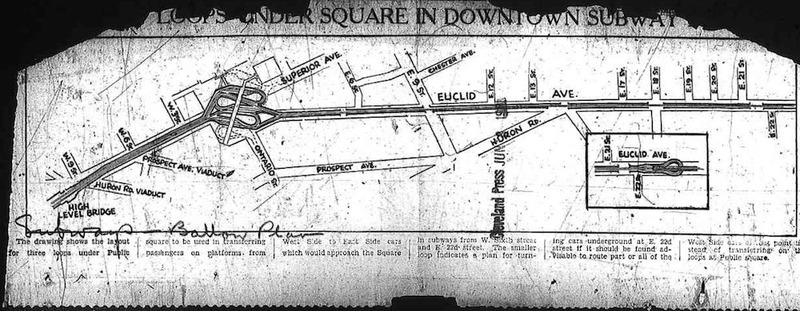
Imagine descending an escalator from USBank Plaza and boarding a subway bound for Tower City Center. Mayor Tom Johnson first proposed a Cleveland subway in 1905, and the idea surfaced repeatedly thereafter. After several failed attempts between the world wars, the city came closest to realizing this dream in 1953, when Cuyahoga County voters approved a $35 million bond issue for a downtown circulator subway by a two-to-one margin. The most discussed route would have traversed a loop from the Cleveland Union Terminal to Superior Avenue and East 9th Street, then to Euclid Avenue and East 13th Street, and back along Huron Road to its origin. Although popular with the public, freeway advocate and county engineer Albert S. Porter persuaded county commissioners to nix the plan in 1957.
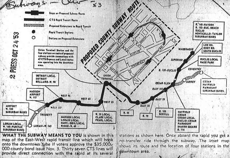
Two years later, Playhouse Square area merchants had grown alarmed by the drop in business that afflicted many American downtown retailers by the late 1950s. With the bond issue set to expire in a matter of months, a group led by officers of the Halle Bros. Co. department store and the owner of the Hanna Building worked behind the scenes to reopen the debate. They got a big boost when the City Planning Commission wrote a subway into Downtown Cleveland-1975, a master plan to guide future development in the city's heart. The plan, which now featured a simpler hook-shaped route under East 14th and Euclid, prompted a bitter feud between downtown interests in Playhouse Square and those near Public Square. The former had long clamored for easier access for transit riders. The latter, especially the Higbee Co. with its advantageous basement entrance adjacent to the Union Terminal rail platforms, frowned upon the subway idea.
It may never be known exactly why the county commissioners voted down the subway again in 1959. Some alleged that a sizable bribe bought the decisive vote against the tube. True or not, it is clear that Porter succeeded in creating a situation ripe for defeat. Although Toronto had recently completed a similar subway that reinforced its downtown as a vigorous hub, Porter warned darkly of buildings collapsing into the "quicksand" beneath Euclid Avenue and stores with their utilities cut off for weeks on end. He insisted that no one who could drive on a new freeway would think of being packed in "sardine" fashion into a railcar.
In the 1980s the idea of a subway reemerged in the form of the Dual Hub Corridor, a combination downtown subway and at-grade rail link with University Circle along Euclid Avenue. As cost estimates soared, the idea was scaled back, and the RTA Healthline ultimately opened as a bus rapid transit system in 2008. Meanwhile, the issue of how to distribute transit riders all over downtown found resolution when downtown interests banded together with RTA to fund a system of free trolley buses whose digital overhead destination signs exclaim, "Smile and Ride Free!"
Video
Audio
Images


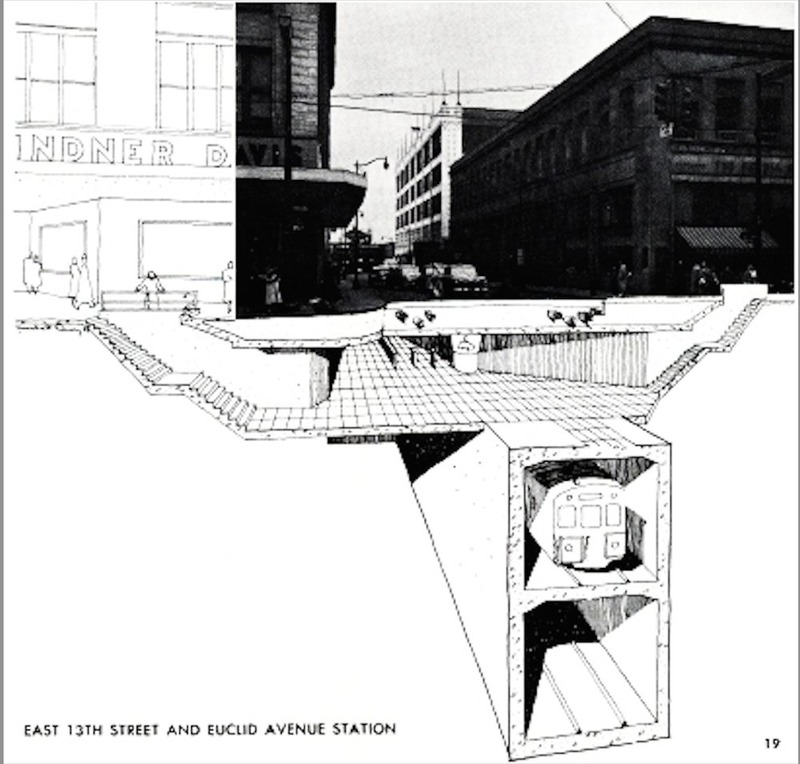
In this cutaway illustration of proposed downtown subway station looking north on East 13th Street from Euclid Avenue, the Sterling Lindner Davis department store is visible to the left. Cowell & Hubbard stands to the right with the Middough Building to its rear. The subway, according to the primary planned loop route, would have run beneath present-day Star Plaza in Playhouse Square. A later variant in the 1959 plan would have placed the Playhouse Square station one block east outside the Hanna Building at Euclid and East 14th. Source: Praeger-Cutting-DeLeuw, Cleveland Subway: Operating and Feasibility (Cleveland, 1955)