<?xml version="1.0" encoding="UTF-8"?>
<feed xmlns="http://www.w3.org/2005/Atom">
  <title type="text">Cleveland Historical</title>
  <updated>2026-08-21T21:28:38+00:00</updated>
  <generator uri="http://framework.zend.com" version="1.12.20">Zend_Feed_Writer</generator>
  <link rel="alternate" type="text/html" href="https://clevelandhistorical.org/"/>
  <link rel="self" type="application/atom+xml" href="https://clevelandhistorical.org/items/browse?output=rss2"/>
  <id>https://clevelandhistorical.org/</id>
  <author>
    <name>Cleveland Historical</name>
    <uri>https://clevelandhistorical.org</uri>
  </author>
  <link rel="hub" href="http://pubsubhubbub.appspot.com/"/>
  <entry>
    <title type="html"><![CDATA[Lake View Park: The Rise and Fall of  Cleveland&#039;s Forgotten First Park]]></title>
    <summary type="html"><![CDATA[<p><strong><em>“Lake View Park! How many can remember the view from there, north, east, west far to the horizon of Lake Erie. Sailing vessels would stand along the sky line, jibs and mainsails immovable as in a picture. Down below passenger engines would move on the Lake Shore tracks, with stately shining stacks, deer horns behind the head lights, and flashing flag rods. From your seat under trees along Summit Street you would look again. Those vessels had moved. You could see it. Slowly creeping ahead until past or off Cleveland’s harbor.” —S. J. Kelly, <em>Plain Dealer</em> columnist (1936)</em></strong></p><img src="https://clevelandhistorical.org/files/fullsize/45bdb96df37dff9953bca297c45eb4e0.jpg" alt="An Artistic Rendition of Lake View Park" /><br/><p>In 1936, Cleveland newspaper columnist S. J. Kelly reminded Clevelanders of the loss of what was once the pride of the Forest City—Lake View Park. The origins of Lake View Park can be traced back to 1867, when a group of citizens visited Mayor Stephen Buhrer to request a lakeside park, leading the city council to recommend acquiring land. In 1869, the Ohio legislature passed a bill that enabled the city council to condemn and purchase land for Cleveland’s first park. Council approved buying property between the lakefront railroad tracks and Summit Street (a street that once ran a block to the north of today’s Lakeside Avenue) from Seneca (W. 3th) to Erie (E. 9th) Streets. In 1871 the mayor appointed the first Board of Park Commissioners, empowering them to levy taxes for park purposes. It took two more years before the land was fully appraised and purchases were completed to assemble ten acres.</p><p>In 1874 the park commissioners authorized issuing $50,000 in bonds for park development. The city then removed the shanties along Summit Street and graded and terraced the bluff. Landscape gardener C. T. Shueren devised a plan of improvements. City workers planted trees, sculpted ponds, and created decorative features. Instead of allowing the entirety of Cleveland’s downtown lakefront to be given over to shipping and industrial interests, the city had used its natural resources to its advantage, opening up the first city park as a showcase for the natural beauty of the lakefront. For the 1876 U.S. Centennial, the park offered a favored vantage point for Clevelanders and out-of-towners to watch a “sham” reenactment Commodore Perry’s battle on Lake Erie. Through ongoing beautification work, by 1885, Lake View Park was reportedly a showplace that must have impressed railroad passengers on the Lake Shore & Michigan Southern line that ran past the lower level of the park.</p><p>Lake View Park included many pathways which visitors could walk through to observe the gorgeous flower fields, rock grottos, manmade lakes, and unique features such as the large fountain—fashioned in the likeness of what observers variously described as a dinosaur, dragon, or lizard—which stood in the middle of the park grounds. The public reception to Lake View Park was overwhelmingly positive, with many praising the naturalistic environment that was in stark contrast to the dominant industrial and commercial sections of the central city.</p><p>Despite the attractiveness of Lake View Park, it was not without its problems. Periodic news reports make clear that by the 1880s, the park already had “acquired a tough reputation.” It was a “rendezvous” for “improper purposes,” “infested by mashers” (a Victorian-era reference to men who sexually harassed women), lined with saloons, and often “virtually deserted.” Given the park’s prime location alongside downtown, existing railroad rights-of-way, and the lake, not to mention the problems the park faced, the city entertained various proposals from business interests to redevelop the area. One proposal in 1889-90 was for a 10,000-seat exposition hall in the park, which it was held would rival similar venues in Detroit and Pittsburgh as a tourist attraction.<span> </span>However, iron and steel interests hoped eventually to expand the industrial usage of the lakefront, and some city officials decried the loss of Cleveland’s only central park on the lake. Ultimately the plan was dropped.</p><p>External pressure from rising industrial powers to replace Lake View Park would be enough for most local governments to consider the offers, especially with the promise of a future economic boom. However, Cleveland officials and citizens regularly pushed back against threats to close the park. Citizens formed committees and brought petitions to court to protect Lake View Park, and the local government regularly hosted events on park grounds to show that interest was still high. However, industrialists’ interest in the lakefront was unmoved by citizen interest in public access to the waterfront. Therefore, it came as little surprise that, in 1907, a new union railroad depot was approved for the Lake View Park site as part of the <a href="https://clevelandhistorical.org/items/show/56">Group Plan</a>. The station plan, however, met with severe backlash in 1910 from park supporters, who argued that the establishment of a railroad depot was antithetical to the very reason that Lake View Park was established and offered a less-people-friendly experience to visitors. Despite grievances from the public, city officials viewed the union depot as far too important to reject. Only the federal government’s concern during World War I about local rail traffic impeding cross-country traffic along the lakefront lines prevented the lakefront union station from reaching fruition.</p><p>Nevertheless, even as the debate over building a union depot raged, the decline of Lake View Park became apparent and too rapid to stop. The worsening pollution caused by the aforementioned railroad, as well as the numerous factories established through the city, suffocated the natural life in the park. The park’s trees and flowers began to wilt and die and its manmade lakes, which were once a beautiful highlight, became toxic and polluted. Despite preventing industrial society from directly destroying Lake View Park, the city was unable to stop the negative effects that industrialism had on the environment, which destroyed the park all the same.</p><p>The effect that pollution had on Lake View Park led to a further drop in attendance, but the park’s end did not come right away. Instead, as is usually the case with redevelopment, it awaited a firm plan that could make it off the drawing board. That firm plan came in early in the 1930s, soon after construction of the multipurpose <a href="https://clevelandhistorical.org/items/show/149">Cleveland Municipal Stadium</a>, when the city built an underground garage for nearby City Hall. By that time, “made land” (or fill) had shifted the water's edge some 1,000 feet to the north, making the “lake view” a more distant one. Ever an astute observer of Cleveland’s changing cityscape, <em>Plain Dealer</em> columnist S. J. Kelly noted that the dragon fountain, once the park’s conversation piece, was headless by that time and carried off by a junk dealer.</p><p>Despite efforts from citizens and local city planners, this beautiful and unique landmark which afforded a place to marvel at the majesty of one of the Great Lakes was allowed to waste away until its final demise went unmourned. Clevelanders today have no memory of Lake View Park, which has been buried beneath parking garages for nearly a century. Lake View Park was a final bastion of naturalist beauty and appreciation along a Cleveland downtown lakefront dominated by capital interests. With its demise, officials, planners, and citizens would struggle for the next century to give Clevelanders a people-friendly lakefront.</p><p><em><strong><a href="https://clevelandhistorical.org/items/show/996">For more (including 9 images) view the original article</a></strong></em></p>]]></summary>
    <published>2022-12-02T03:42:46+00:00</published>
    <updated>2026-04-17T19:17:42+00:00</updated>
    <link rel="alternate" type="text/html" href="https://clevelandhistorical.org/items/show/996"/>
    <id>https://clevelandhistorical.org/items/show/996</id>
    <author>
      <name>Will Bailie</name>
    </author>
  </entry>
  <entry>
    <title type="html"><![CDATA[Captain Frank&#039;s Lobster House: A Particularly Fishy Experience]]></title>
    <summary type="html"><![CDATA[<img src="https://clevelandhistorical.org/files/fullsize/137de784206c840502eb98dfb2cc1331.jpg" alt="Fish in the Fifties" /><br/><p>Literally and figuratively, Captain Frank’s covered the waterfront. On any given day, visitors to the East 9th St. Pier restaurant might be felled by wilting humidity or blistering wind. Once inside, they could order anything from hake to steak. Some remember the place as “wonderful” with the “best seafood.” Others describe it as “filthy,” “dimly lit,” and “a little creepy.” Many recall “fun times” in and out, but more than a few witnessed depressed, intoxicated or careless motorists drive their cars off the pier into the lake. Even the signage was fluid: Depending on the year, Captain Frank’s might be a “Lobster House” or a “Sea Food House.” </p><p>For 35 years, in fact, dichotomy and variety consistently defined Captain Frank’s. Patrons could enjoy the sounds of a nearby Cleveland Indians baseball game or watch planes take off and land at Burke Lakefront Airport. Or perhaps they’d watch a romantic sunset; converse with fishermen; absorb Lake Erie’s dubious smells; or fend off panhandlers, including one guy who lived outside the restaurant and called himself “Captain Frank.” The establishment was dry for its first five years, but later customers remember “power cocktails between double shifts,” free drinks for politicians, and compliant service to high schoolers. </p><p>Captain Frank was Frank Visconti, a Sicilian immigrant who emigrated to the United States in 1914, sold fish from a horse-drawn buggy and, for a time, operated the old Fulton Fish Market at East 22nd Street and Woodland Avenue. In 1953, Visconti bought an abandoned boat depot on the pier and turned it into one of Cleveland’s best-known restaurants. The structure burned in 1958 but reopened within a year. It flourished in the 1960s and 1970s, with great lake views, an indoor waterfall, festoons of fishing nets and frequently dirty lobster tanks providing all the ambiance families and couples could want. Notables ranging from Nelson Eddy, Judy Garland and Flip Wilson to Mott the Hoople and the Shah of Iran partied into the wee hours (or until they were asked to leave). </p><p>The structure itself actually housed several businesses; the Cleveland Seamen’s Service had offices on the north side of the restaurant and Visconti operated a luncheonette behind his restaurant. Old timers also recall a “custard stand” which may actually have been the luncheonette. </p><p>Visconti died in 1984. The restaurant limped along for another five years; but growing competition, increasingly mediocre food and service, and the fading allure of downtown were too much. New owner Rudolph Hubka, Jr., declared bankruptcy in 1989 and the building was demolished in 1994. Today, visitors to a reborn East 9th Street Pier can experience Mexican food, volleyball, bike tours and boat cruises. But the area’s offshore sights, sounds and smells can still invoke memories of untold fishy experiences. </p><p><em><strong><a href="https://clevelandhistorical.org/items/show/901">For more (including 5 images) view the original article</a></strong></em></p>]]></summary>
    <published>2020-01-20T16:07:07+00:00</published>
    <updated>2026-04-17T19:17:39+00:00</updated>
    <link rel="alternate" type="text/html" href="https://clevelandhistorical.org/items/show/901"/>
    <id>https://clevelandhistorical.org/items/show/901</id>
    <author>
      <name>Chris Roy</name>
    </author>
  </entry>
  <entry>
    <title type="html"><![CDATA[Burke Lakefront Airport: The Landfill Airport]]></title>
    <summary type="html"><![CDATA[<img src="https://clevelandhistorical.org/files/fullsize/4da6a05500e4caf70e871485f8b69af6.jpg" alt="Burke Lakefront Airport" /><br/><p>In 1923, the Air Service, a part of the U.S. Army, published and distributed a basic how-to manual on airport construction for America’s cities. This publication, titled “Airways and Landing Fields,” contained information on the Model Airway program as well as a list of suggestions to be followed by a city on “How An Airport Should Be Built.” These suggestions listed in the Air Services bulletin regarded the location suitable for building, related to the size and shape, ground material, markings and accommodations. These attributes that the Air Service bulletin prescribed included being within proximity to ground transportation, merchandise and business districts of a city, which the City of Cleveland took to a different level for building its second an airport. </p><p>The lakefront and its subsequent use or misuse, as the case may be, has been a point of contention among Clevelanders for decades. Before the turn of the twentieth century there had been a park on top of the bluff overlooking the lake, appropriately if unimaginatively named <a href="https://clevelandhistorical.org/items/show/996">Lake View Park</a>. Then during the Great Depression the shoreline between what is now called East 9th Street and East 12th Street was a dumping ground for the city’s refuse both material and human. In this area a makeshift “Hooverville” as shantytowns were christened after President Hoover, was constructed by the hundreds of jobless and homeless Clevelanders as a result of the Depression. To combat this refuse and homeless problem several influential and wealthy Clevelanders put forth an idea to clear the area and build a World’s Fair type event in the location. This event would be known as the <a href="https://clevelandhistorical.org/items/show/71">Great Lakes Exposition</a> of 1936. During the exposition, future ideas and plans were proposed, displayed and developed about what use the lakefront could be to the city. Eventually the most practical solution was proposed of transportation facilities either marine or aerial in nature. The proposal contained the early building blocks for a lakefront plan that included the entire shoreline of the city of Cleveland and would contain an aviation point which would become Burke Lakefront Airport. The Lakefront area where the refuse and Great Lakes expositions were once located was not suitable enough for a full-fledged airport according to the Air Services suggestions made in 1923. Nevertheless, a Lakefront location for an airport was seen locally as a huge draw for tourists, businessmen and Clevelanders alike. Proposed as only a short ten-minute drive from Public Square in the center of the city, it was viewed by many as what could be a great alternative to the more distant Cleveland-Hopkins Airport. </p><p>In the early 1940s construction on a dike retaining wall in Lake Erie by the U.S. Army Corps of Engineers began, which was the outer support area, where within the interior was to be completely filled with hundreds of tons of dirt dredgings from the Cuyahoga River. The interior area was partially completed and secure enough in August 1947 for a temporary runway to be built and the first airplane to land at the site. On the shoreline, off Memorial Shoreway and in between East 9th and East 12th Streets Mayor Thomas Burke and Major John Berry, City Commissioner of Airports, were on hand to perform an opening ceremony with the first plane to land at the site. Over the next year the Army Corps of Engineers continued to develop what would become the permanent airport by depositing over 700,000 cubic yards of dredging on both the east and west ends of the temporary runway. </p><p>Even though the completed airport was far from completion, within about five years, it still managed to set records for the numbers of flights and passengers traveling through the area in 1949. There was a total increase of about 200 aircraft and over 400 more passengers than in the previous year. The 1950s saw a need for the attribution of more money through bonds to make improvements and completions to the Lakefront Airport. The 1960s were a decade of change and celebration surrounding the nearly completed Lakefront Airport. Continuous flights were flying in and out of the Lakefront Airport, and the first commercial business, Lake Central Airlines, planned to move some operations to the Lakefront Airport. A Nike missile facility that was built near the Lakefront Airport in the late fifties was shut down with updates to technologies which rendered the site obsolete. </p><p>Controversy and near closure followed the airport surrounding the proposed installation of a new heavy-lift crane at the West 3rd Street docks. The proposed site would have caused disruptions to the flight paths of planes into and departing the Lakefront Airport. This was such a controversy that even Port Director William Rogers proclaimed that he would quit if the city approved the proposed crane installation on the piers north face. </p><p>Throughout all this, entertainment was still to be had in the form of high-flying action during the annual Memorial Day air shows held at Burke Lakefront Airport especially in the form of the "Girl on the Wing" (aircraft wing walks by stuntwomen). The 1970s saw expansion at Burke Lakefront Airport with a focus on attracting more small airlines providing destinations such as roundtrip flights to Detroit, Michigan. An increase in numbers of flights and passengers from the sixties into the seventies produced a need for construction of new West and East Concourses. The 1980s, on the other hand, saw no further expansion of buildings or rise in numbers of passengers or flights but instead the inclusion of a new opportunity for an entertainment location for the city. The first Cleveland Grand Prix (similar to the Indianapolis 500) was held on the airport's runways and approach aprons on July 4, 1981. </p><p>Over the years since its heyday, Burke Lakefront has steadily lost numbers in planes delivering cargo as Cleveland lost its onetime #3 rank as a Fortune 500 headquarters city, and as many companies moved toward larger planes that the airport could not support. The land on which the airport sits has also been a contentious subject for Clevelanders, although unlike Mayor Daley in Chicago with his midnight raid to destroy Meigs Field and avoid court proceedings and costs, Burke has remained as Clevelanders continue to discuss and debate the future of the airport.</p><p><em><strong><a href="https://clevelandhistorical.org/items/show/889">For more (including 12 images) view the original article</a></strong></em></p>]]></summary>
    <published>2019-11-26T02:41:59+00:00</published>
    <updated>2026-05-21T20:43:55+00:00</updated>
    <link rel="alternate" type="text/html" href="https://clevelandhistorical.org/items/show/889"/>
    <id>https://clevelandhistorical.org/items/show/889</id>
    <author>
      <name>Ryan Oergel</name>
    </author>
  </entry>
  <entry>
    <title type="html"><![CDATA[Cleveland Lakefront Reservation: The Long Struggle to Maintain the City&#039;s Lakefront Parks]]></title>
    <summary type="html"><![CDATA[<img src="https://clevelandhistorical.org/files/fullsize/679dd9b50e9291e954a7c85e132098bd.jpg" alt="Edgewater Beach and Skyline" /><br/><p>Since 2013 Cleveland’s lakefront parks have been run by the Cleveland Metroparks. Before the Metroparks assumed administration of the parks, the state of Ohio operated them as units of the Cleveland Lakefront State Park, and before that the city of Cleveland’s Board of Park Commissioners controlled these parks. It was a long road of pollution and vandalism that led to Metroparks control over the lakefront parks. Each previous administration started out with a good budget and short-term plans for the lakefront parks, but long-term maintenance issues ultimately undermined each administration’s stewardship of the parks. </p><p>The urban park movement came rather late to Cleveland, emerging in September 1865 when a city council committee was appointed to consider the establishment of public parks. Finally, after new state laws were enacted, in 1871 Cleveland’s Board of Park Commissioners was created. In 1874 the park board began selling park bonds to finance land acquisition and improvements to create several parks, including Lake View Park. This park stood on the natural bluff overlooking the Lake Erie until Municipal Stadium (later replaced by today’s FirstEnergy Stadium)—built on fill that extended the lakeshore northward—blocked the view. Cleveland’s parks started to take shape over the next ten years through various donations, but they lacked in comparison to park development in other cities with populations similar to Cleveland’s, and with growing urbanization it seemed that the city was running out of land to set aside for parks. Various state legislation led to an increase in park power, and by 1900 Cleveland would gain ten new parks totaling over 1,200 acres, approximately two thirds of which had been donated. Finally a good amount of Cleveland’s lakefront had been saved for parks and conservation in <a href="https://clevelandhistorical.org/items/show/121">Edgewater Park</a>, <a href="https://clevelandhistorical.org/items/show/143">Gordon Park</a>, and <a href="https://clevelandhistorical.org/items/show/996">Lake View Park</a>.</p><p>With so much newly acquired land, the park system started to struggle with the biggest problem that would plague the lakefront. Even the bonds the park commissioners sold could only be used to purchase new lands, not maintain them. Through the first twenty years of the 1900s, multiple public works projects were completed to appease the residents who claimed the city only opened parks away from the urban center. Cleveland’s combined storm water sewage system was also being completed at this time and the water treatment plants sat basically at the edge of Edgewater Park and Gordon Park. On most days the water treatment plant could do its job but with heavy rain, Cleveland’s sewers combined storm water and sewage, dumping the sludge into Lake Erie. </p><p>As in other cities, Cleveland’s parks would serve as a major focus for WPA workers during the Great Depression, but as people left for World War II, vandalism struck the lakefront parks. Continually the parks’ budget got smaller and smaller, not to mention that the Memorial Shoreway sliced through most of the lakefront parks by the 1950s. A series of Cuyahoga River fires culminated in national attention to Cleveland’s growing water pollution problem by 1969. Although the federal government passed the Clean Water Act of 1972, leading to gradual improvements in water quality, little progress was made in curbing the pollution problem in the lakefront parks. No longer able to keep up its coveted park system Cleveland was once so proud of, the city signed a long-term lease with the Ohio Department of Natural Resources, making Edgewater, Gordon, and Wildwood Parks part of a new Cleveland Lakefront State Park.</p><p>The new state park lasted until 2013. The state put together a 100-year plan for the state of the Lakefront Park in 1984, implementing facilities for fishing, boating, swimming, and picnicking and day-use facilities at all designated park areas, but it was only loosely followed over the ensuing years. The main area of attention was cleaning the polluted waters and lakefront which had become a virtual dumping ground. The lakefront continued to change when newly elected mayor Michael White proposed several different projects two years before Cleveland’s bicentennial in 1996. The plan, dubbed North Coast Harbor, included a new science center, an aquarium, and many improvements to the port included a new Regional Transit Authority (RTA) waterfront rapid line. The plan, totaling more than $285 million, promised to make the Cleveland Lakefront State Park Ohio’s most visited state park.</p><p>Although the plan was only partially realized, the lakefront still saw heavy use and, unfortunately, slipping maintenance. As one city council member described in 2004, the parks had become overgrown, the beaches littered with debris, and public bathrooms in deplorable shape. The state simply did not have the funding after cuts, and residents started discussing giving control to the Cleveland Metroparks. Over the next decade it became clearer through the continued pollution that a change was direly needed. After the Clevleand Metroparks assumed stewardship of the parks from the state in 2013, the city gave the Metroparks $15 million for cleanup and upgrades. The Cleveland City Planning Commission, along with the Cleveland Metroparks, put out a waterfront district plan in 2014 to decide the future of the area. The best fit for the lakefront parks seems to be control by a dedicated parks organization committed to long-term conservation. Cleveland Metroparks has answered the call.</p><p><em><strong><a href="https://clevelandhistorical.org/items/show/796">For more (including 9 images) view the original article</a></strong></em></p>]]></summary>
    <published>2017-05-13T21:56:04+00:00</published>
    <updated>2026-04-17T19:17:41+00:00</updated>
    <link rel="alternate" type="text/html" href="https://clevelandhistorical.org/items/show/796"/>
    <id>https://clevelandhistorical.org/items/show/796</id>
    <author>
      <name>Connor Kenney</name>
    </author>
  </entry>
  <entry>
    <title type="html"><![CDATA[Rock and Roll Hall of Fame and Museum: Why is the Rock Hall in Cleveland?]]></title>
    <summary type="html"><![CDATA[<p><strong><em>After Rock and Roll Hall of Fame Foundation leaders visited Cleveland in July 1985, they were very impressed with the city's rock roots. But rather than picking Cleveland right away, they decided to hold a national competition to pick the location. The race to land the Rock Hall was on.</em></strong></p><img src="https://clevelandhistorical.org/files/fullsize/804da837ed89452cfc8762f839a3576e.jpg" alt="Grand Opening, 1995" /><br/><p>In 1979, the year that Ian Hunter released “Cleveland Rocks,” the <i>Wall Street Journal</i> proclaimed Cleveland the nation’s “Rock and Roll Capital.” The city had earned this reputation through the influence of WJW disc jockey Alan Freed, Record Rendezvous owner Leo Mintz, jukebox supplier and, later, <a href="https://clevelandhistorical.org/items/show/1">Agora Theater</a> operator Hank LoConti in breaking emerging talent. It didn’t hurt that downtown Cleveland also housed many of the leading record companies’ warehouses, which supplied a seemingly insatiable demand for rock among Cleveland youth. Despite the city’s strong reputation as a rock and roll town in the 1970s, Cleveland was suffering a dismal decade economically. At a time when Cleveland had become the butt of jokes on national television, few could have imagined the city’s landing one of the world’s most iconic shrines to rock and roll.</p><p>The idea for a Rock and Roll Hall of Fame was conceived by Atlantic Records founder and R&B producer Ahmet Ertegun. Ertegun and other music industry luminaries formed the Rock and Roll Hall of Fame Foundation in 1983 in hopes of creating a permanent shrine to rock music. The Foundation planned to locate the new facility in Manhattan, close to the heart of the recording industry, and at first few outsiders had any inkling of the plan. In Cleveland, Hank LoConti and his friends separately envisioned a museum to honor the city’s seminal role in popularizing rock music, particularly local disc jockey Alan Freed’s coining of the term “rock and roll” and hosting the first rock concert, the Moondog Coronation Ball, in 1952.</p><p>Through Norm N. Nite, a Cleveland native with close ties to New York’s music scene, LoConti learned of the Foundation’s plan for a rock and roll shrine. Nite agreed to present Cleveland to Ertegun as an alternative site for the Rock Hall. Nite opened the door for a contingent of Cleveland boosters to present their case to the Foundation. Armed with letters of support from Cleveland’s leading cultural institutions, the group highlighted Cleveland’s claim as the cradle of rock—including Freed and the Moondog Coronation Ball; the role of LoConti’s Agora and radio station <a href="https://clevelandhistorical.org/items/show/978">WMMS</a> in breaking new talent (including David Bowie, Rush, and Bruce Springsteen); and longtime music businesses like Record Rendezvous and Record Revolution—as well as the fact that a Rock Hall would be a singular tourist attraction in Cleveland but only one among many competing points of interest in Manhattan.</p><p>After a July 1985 visit to Cleveland by Foundation leaders, the Foundation decided to hold a national competition to host the venue. The race to land the Rock Hall was on, with Cleveland, Memphis, New York, San Francisco, New Orleans, and Philadelphia as leading contenders. All cities vying for the Rock Hall pointed to the star power behind their respective bids. San Francisco used (Jefferson) Starship’s hit “We Built This City” as a theme song for its bid. Cleveland claimed support from Michael Jackson, the Kinks, and some 50 other musicians. As the selection process progressed, the choice narrowed to Chicago, Philadelphia, and Cleveland. Spurred by WMMS, 120,000 listeners voted for Cleveland as the Rock Hall site in a <i>USA Today</i> poll. Then Cleveland backers gathered 600,000 signatures on a petition that the Greater Cleveland Growth Association presented to the Foundation in New York. They banked on more than just the city’s preeminent historical stake in the genre—turning to the city and state governments and local Foundations, which collectively raised $26 million to lure the Rock Hall. Thanks largely to these efforts, the Foundation selected Cleveland in May 1986.</p><p>Once Cleveland got the nod, attention turned to a site. Early prospective locations for the Rock Hall included the lakefront, Public Square, the Flats, Playhouse Square, the Mall, and a couple of sites along Huron Road behind the Terminal Tower. Ruling out the adaptive reuse of an old building, Rock Hall officials opted for a “signature building” at the urging of architect I. M. Pei, whom the Foundation retained to design the hall despite his public admission that he knew little about rock music. The Foundation selected Tower City as the preferred site. Pei’s original design included an 18-story glass tower overlooking the Cuyahoga River with a concourse connecting to the Tower City Center complex.</p><p>Relations between Cleveland and New York soured by 1989, notably when the Foundation announced it would keep induction ceremonies in Manhattan rather than moving them to the Cleveland Rock Hall. In addition, Clevelanders’ tax dollars would be required, thus diverting millions of dollars away from the city’s school system—a stark contrast to what a <i>Plain Dealer</i> editorial called “a rock ’n’ roll industry grown fat on its successes.” The Rock and Roll Hall of Fame’s construction cost ballooned to $100 million, four times the original budget. When a record store opened inside Tower City in 1990, Rock Hall officials became angry and began to look at other sites besides Huron Road, which they now claimed was too small to permit construction. After several anxious months, a new site was chosen on city-owned land at North Coast Harbor. With the new location came a reduction in height. Pei’s glass tower was too tall to place so near Burke Lakefront Airport. Instead a shorter tower and glass pyramid design emerged, evoking the slanted glass wall of his Louvre design. The Rock Hall opened in September 1995.</p><p>While Cleveland civic leaders rightly lauded the Rock Hall as a coup for the city’s image and economy, many musicians and fans were ambivalent; a few were outright hostile to the very idea of a museum for rock and roll. In contrast to the music industry leaders who saw the Rock Hall as a means to foster mainstream appreciation for rock and roll’s cultural impact, many saw irony in the formal enshrinement of rock and roll, an art form often associated with rebellion and counterculture. As one reporter observed of the first induction ceremony in New York in the 1980s, “Once the sole-soul property of gifted wild men who shocked America with their three-chord songs, rock ’n’ roll is now so middle class it was accorded a most civilized honor…. It was given a dinner.”</p><p><em><strong><a href="https://clevelandhistorical.org/items/show/704">For more (including 12 images&#32;&amp;&#32;5 audio files) view the original article</a></strong></em></p>]]></summary>
    <published>2015-04-28T09:17:46+00:00</published>
    <updated>2026-04-17T19:17:40+00:00</updated>
    <link rel="alternate" type="text/html" href="https://clevelandhistorical.org/items/show/704"/>
    <id>https://clevelandhistorical.org/items/show/704</id>
    <author>
      <name>CSU Center for Public History and Digital Humanities</name>
    </author>
  </entry>
  <entry>
    <title type="html"><![CDATA[Air Show Plaza]]></title>
    <summary type="html"><![CDATA[<img src="https://clevelandhistorical.org/files/fullsize/907250b4369d451636f1d6ee5a387d33.jpg" alt="Air Show Plaza at Burke Lakefront Airport" /><br/><p>The Marjorie Rosenbaum Plaza at Burke Lakefront Airport celebrates the "Golden Age of Aviation" when Cleveland hosted the National Air Races eleven times between 1929 and 1949. It was during this era that Cleveland was referred to as the "Indianapolis 500 of the Air." The Plaza also celebrates the modern day Cleveland National Air Show held at Burke Lakefront Airport  since 1964.</p><p>Granite plaques that ring the Air Show Plaza tell the stories of the National Air Races held in Cleveland between 1929-1949 including legendary pilots who flew here: Amelia Earhart; Charles Lindbergh; Jimmy Doolittle; and Roscoe Turner. The plaques tell the stories of some of the famous airplanes including the GeeBee air racer flown to victory by Jimmy Doolittle in 1932 in the Thompson Trophy speed pylon race. Also featured are stories of the incredible women air racers in those early years (including Amelia Earhart) who flew in the National Air Races. The finish line of the "Powderpuff Derby" women's distance race from Santa Monica, California to Cleveland was in front of of cheering fans in the Grandstand at Cleveland Municipal Airport (now Hopkins Airport), the location of the National Air Races in Cleveland until 1949.</p><p>The National Air Races were discontinued in Cleveland after 1949 (partially due to a fatal crash of a P-51C air racing plane flown by Bill Odom in Berea, Ohio during the 1949 National Air Races.) The current Cleveland National Air Show at Burke Lakefront Airport returned in 1964 and has become a Labor Day Weekend tradition in Cleveland and is one of the oldest and best annual air shows in America.</p><p>The Air Show Plaza features two F-4 Phantom jets on pedestals painted in the color schemes of the U.S. Navy Blue Angels and the U.S. Air Force Thunderbirds. Both demonstration teams have performed at the Cleveland National Air Show many times. (The F-4 was the only airframe used by both the Blue Angels and the Thunderbirds at the same time.) Walk of Fame plaques that circle the Plaza celebrate the modern day Cleveland National Air Show since 1964 at Burke Lakefront Airport. These Walk of Fame plaques showcase some of the legendary flying acts and performers who have appeared at the Cleveland National Air Show since 1964.</p><p>The Air Show Plaza is named for benefactor Marjorie Rosenbaum, wife of Cleveland National Air Show Board Member and former Chairman Jacob Rosenbaum. </p><p><em><strong><a href="https://clevelandhistorical.org/items/show/505">For more (including 11 images) view the original article</a></strong></em></p>]]></summary>
    <published>2012-06-17T12:57:27+00:00</published>
    <updated>2026-04-17T19:17:39+00:00</updated>
    <link rel="alternate" type="text/html" href="https://clevelandhistorical.org/items/show/505"/>
    <id>https://clevelandhistorical.org/items/show/505</id>
    <author>
      <name>F.X. O&amp;#039;Grady</name>
    </author>
  </entry>
  <entry>
    <title type="html"><![CDATA[Donald Gray Gardens: Great Lakes Exposition]]></title>
    <summary type="html"><![CDATA[<img src="https://clevelandhistorical.org/files/fullsize/215bcf92919ba548bb90cfeb1c650e21.jpg" alt="Sunken Garden in Donald Gray Gardens" /><br/><p>The Donald Gray Gardens were situated on 3.5 acres of lakefront just to the north of Cleveland Municipal Stadium. The gardens and the Horticulture Building (1000 feet to the west of the gardens) were built in 1936 as part of the Great Lakes Exposition. One visiting the Expo had to pay twenty-five cents to reach the gardens, entering through the building. Ironically, the gardens sat on what was once the city dump, also a haven for the homeless during the Great Depression. Winsor French of the <em>Cleveland Press</em> remarked on this saying, "Incredible, to pass a dump one day and the next to find it a garden, complete with rolling lawns and flowering shrubs, but that's the way they do things."</p><p>Hundreds of workers from the New Deal's WPA (Works Progress Administration) were in charge of planting and landscaping the gardens. The man who designed the gardens was a prominent Cleveland architect by the name of A. Donald Gray who also had a private landscaping business and served as gardening editor for the Cleveland Press. Gray accomplished the task of constructing the gardens in only sixty-eight days. He created a rich and diverse setting in his landscape with waterfalls, ferns, mosses, vines, annuals, perennials, and rhododendron, to name just a few. Different gardens existed within the space, too, such as the various nationality gardens in the "Gardens of the Nations" and period gardens representing the eras of the frontier, Civil War, World War I, and the garden of the future. Expo visitors could relax in the gardens and enjoy views of Lake Erie on one of the many benches that lined a gravel walkway. </p><p>The Horticulture Building, meanwhile, was 60 feet wide and stretched 190 feet in length, with outdoor terraces at the top two levels holding umbrella tables and floral boxes It was built with the intention of being one of the permanent gifts left behind after the two year Expo ended, along with the gardens and the East 9th Street underpass. The building was designed in a modern, oval-tiered shape. Its fifty-foot tall entrance was embellished with Roman-style murals depicting harvesting and gardening scenes intricately painted by local artists. The building was under the sponsorship of the Garden Center of Greater Cleveland with contributions from other groups such as the Mentor Headlands Garden Club and Our Garden Club of Rocky River. Chairman of the project was Mrs. Elizabeth Mather, who planted the first tree outside the gardens. There were rotating flower shows in the building each month, along with space for garden club meetings and exhibition areas. </p><p>Unfortunately, the Horticultural Building burned down in 1941, only five years after it had opened. The gardens, however, lasted longer than any other part of the Expo. Indeed, they remained in their original location north of Municipal Stadium until being dug up and destroyed during the construction of the new Cleveland Browns Football Stadium in the late 1990s.</p><p><em><strong><a href="https://clevelandhistorical.org/items/show/291">For more (including 9 images&#32;&amp;&#32;2 audio files) view the original article</a></strong></em></p>]]></summary>
    <published>2011-07-24T09:05:50+00:00</published>
    <updated>2026-04-17T19:17:38+00:00</updated>
    <link rel="alternate" type="text/html" href="https://clevelandhistorical.org/items/show/291"/>
    <id>https://clevelandhistorical.org/items/show/291</id>
    <author>
      <name>Judy MacKeigan</name>
    </author>
  </entry>
  <entry>
    <title type="html"><![CDATA[White City Park: Entertainment, Amusement, and Leisure on the Lake Erie Shore]]></title>
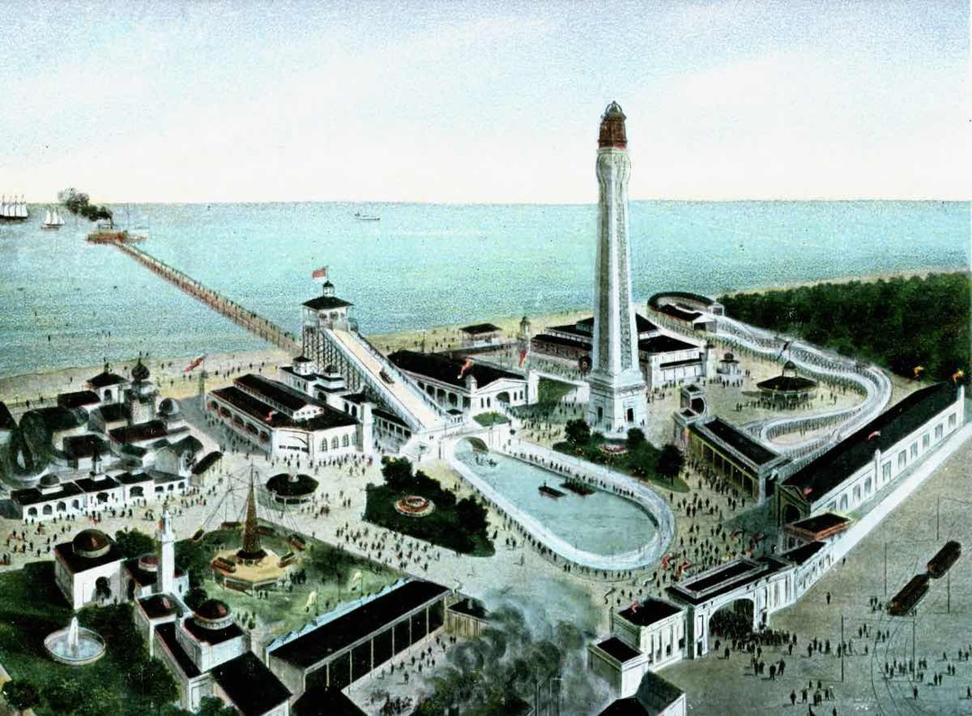
    <summary type="html"><![CDATA[<p><strong><em>White City was noted for its amusements, attractions, and recreational activities as businessmen and politicians commanded its fate for more than a century in a growing and prospering city.</em></strong></p><img src="https://clevelandhistorical.org/files/fullsize/9b21074194c03a9d4834bf53f1d1400f.jpg" alt="Aerial View of White City" /><br/><p>During the 1970s the area that now occupies the western edge of Cleveland’s Easterly Wastewater Treatment Plant was still known as White City Park. The tract of land bordered by Bratenahl Village to the west and the city sewer authority property to the east existed as a public park in various incarnations since 1900. Lake Shore Boulevard bounded its entrance to the south at East 140th Street in Collinwood Village (later annexed by Cleveland). The park's lakeshore was attractive to swimmers, fishermen, and boaters for the rest of the 20th century.  White City Park has shared several names and faces over the past century.</p><p>The 1.5-mile lakefront area to the east of Bratenahl Village was originally known as Manhattan Beach and is still informally named that today. The “White City” space noted above was first cited in the Cleveland Plain Dealer in June 1900 as Manhattan Beach Park in announcements of fraternal organization and secret society gatherings. The park also hosted baseball, bowling, a dance hall, entertainment, and a bathing beach. Its entertainment value to the Collinwood Village neighborhood was evident with the newspaper announcements and stories of daily activities and events at the park from 1900 to 1904. One socio-political dispute played out in the park and among its nearby neighbors. The Beal Law provided local options concerning alcohol sales and consumption. The dispute between the ‘wets’ and the ‘drys’ in the Collinwood community carried on for years. Undercover detectives were dispatched to the area in and around Manhattan Beach Park to ensnare alcohol salesmen for the Collinwood Mayor’s court. Repeated polling switched the wet-dry rules three times between 1902 and 1908 prior to Collinwood’s annexation into Cleveland in 1910, but stories abounded about the behavior in the neighborhood. Edward C. Boyce purchased Manhattan Beach Park early in 1905 with the intent to further develop it into an amusement park. </p><p>In the golden era of Cleveland’s amusement parks, White City Amusement Park was one of many built to compete with the most successful of them all, Euclid Beach Park, about a mile east on the lake, and was even served by the same streetcars. The two parks became common destinations for a day’s outing for the few seasons that White City Park and Euclid Beach Park were neighbors. White City Park shared a common design with the famous New York-based Coney Island. Ed Boyce, an owner of Coney Island’s Dreamland Park, adopted its concepts to build White City Park. The general idea was to bring in attractions, entertainers, and celebrities to draw people to the park. The Park was built in eleven weeks and featured a boardwalk, Shoot the Chutes, the Bostock Animal Show, Bump-the-Bumps, a scenic railway, and a midway which featured Drs. Couney and Stewart’s infant incubator hospital. About 20 premature babies, referred by Cleveland area physicians, were under care and on display as the best and most promising hope for infant survival. The first ‘resident’ arrived in June 1905 in time for the Park’s opening. The hospital gained local notoriety with full capacity and subsequent reunion celebrations in years to come.</p><p>Cleveland, however, suffered from a lack of star power and the Dreamland concept was less than successful. Unlike Euclid Beach, White City Park charged an admission fee, which hurt its business. After a fire burned down over half of the park in 1906 and a windstorm caused severe damage in 1907, the owners had been through enough. White City Park was closed in 1908 after only four years in operation. In 1909, new owners reopened it as Cleveland Beach Park to host local gatherings, much like Manhattan Beach Park did earlier in the decade. Between 1909 and 1911, investors and managers combined to rename attractions at White City. The Cleveland Trust Co. foreclosed on the property, a sheriff’s sale ensued, and M. F. Bramley bought White City land and Luna Park with the intention to manage several amusement parks in the region. He remodeled the property once more as Bay Park [Amusement Co.] in 1911, just barely long enough to be noted on some local maps. The company ceased operations within two months, spelling the end of amusement park activity.</p><p>The next several years saw White City revert to ‘city park’ mode with accommodations for picnic and game grounds and beach access. Much of the news concerning the area was devoted to the development of the adjacent sewage treatment plant serving Cleveland’s east side. Later in the decade, the grounds were devoted to stables and drill and practice by National Guard troops training for threatening World War I border duty. </p><p>Through the ensuing decades, the city of Cleveland maintained the park for swimming, fishing, and boating under the auspices of the White City Yacht Club and the Northeast Yacht Club despite occasionally dangerous water quality conditions created by the neighboring sewage treatment facility’s deficiencies. The constants which remain today through the evolving story of Collinwood’s northwestern shore, then and 100 years hence, are White City Park and the Manhattan Beach neighborhood.</p><p><em><strong><a href="https://clevelandhistorical.org/items/show/262">For more (including 15 images) view the original article</a></strong></em></p>]]></summary>
    <published>2011-07-17T16:14:48+00:00</published>
    <updated>2026-04-17T19:17:38+00:00</updated>
    <link rel="alternate" type="text/html" href="https://clevelandhistorical.org/items/show/262"/>
    <id>https://clevelandhistorical.org/items/show/262</id>
    <author>
      <name>Jim Lanese</name>
    </author>
  </entry>
  <entry>
    <title type="html"><![CDATA[Huntington Reservation: A Hobby Farm Turned Public Beach]]></title>
    <summary type="html"><![CDATA[<img src="https://clevelandhistorical.org/files/fullsize/af3c8185bbfe7dea5512b21e86f51779.jpg" alt="Beach Postcard" /><br/><p>Today, the Huntington Reservation is known mostly for its beach, leaving visitors unaware of the rich history of the land beneath their sand filled shoes.  However, it is possible for one to stand on the Lake Erie shore and imagine Native Americans holding powwows inside mammoth sycamore trees, or bison strolling along the Indian path that would later become Lake Road.  Or perhaps one can imagine standing in the orchards and vineyards of Bay Village's earliest pioneers, or hearing the echoes of industrialist John Huntington's steam engine pumping water from Lake Erie to irrigate his hobby farm and bring drinking water into his stately summer home. </p><p>This 100-acre chunk of Lake Erie shoreline in Bay Village truly has a deep and influential history that extends far back beyond its purchase by the Cleveland Metroparks in 1925 for $500,000. For thousands of years prior to European arrival in the New World, it was part of an attractive hunting ground for Native Americans. The area became largely empty in the century prior to the Revolutionary War, however, after inter-tribal wars over control of the lucrative trade in beaver pelts forced many natives to leave. Claiming the area south of Lake Erie through creative cartography, Connecticut surveyors, most famously Moses Cleaveland, began parceling land along the south shore of Lake Erie in 1796. The land that became Bay Village was surveyed and laid out in 1806, by which point all Indian claims in the area had been extinguished. Two land speculators soon purchased the empty township and named it after their home town of Dover, Connecticut. The Lake Erie microclimate provided excellent growing conditions for orchards and vineyards for early settlers once the land near the shore was cleared of massive 17-foot circumference sycamore trees. Pioneers began settling and farming fruit in Dover Township around 1810.  </p><p>In 1880, the most desirable 100 acres of the Dover Township shoreline became a summer retreat and hobby farm for John Huntington (1832-1893), a wealthy Cleveland industrialist with ties to John Rockefeller's Standard Oil Company.  In addition to building a fine house on the land, Huntington, an inventor and avid tinkerer, constructed a water tower and maintained a steam pump system to irrigate his orchards and gardens.  He built several other structures on his property, a few of which remain standing today.  </p><p>The Cleveland Metroparks purchased Huntington's estate in 1925, allowing the public to visit and contemplate the past historical eras in which this spot of lakeshore once played a part, or to just enjoy a cool Lake Erie breeze on a hot summer day.</p><p><em><strong><a href="https://clevelandhistorical.org/items/show/244">For more (including 7 images&#32;&amp;&#32;4 audio files) view the original article</a></strong></em></p>]]></summary>
    <published>2011-07-11T09:17:17+00:00</published>
    <updated>2026-04-17T19:17:37+00:00</updated>
    <link rel="alternate" type="text/html" href="https://clevelandhistorical.org/items/show/244"/>
    <id>https://clevelandhistorical.org/items/show/244</id>
    <author>
      <name>Rob Grossman</name>
    </author>
  </entry>
  <entry>
    <title type="html"><![CDATA[Municipal Stadium]]></title>
    <summary type="html"><![CDATA[<img src="https://clevelandhistorical.org/files/fullsize/stadium-cmp-paigewithveeck48_2ab6e3a5ae.jpg" alt="Satchel Paige and Bill Veeck, 1948" /><br/><p>The demolition of Cleveland Municipal Stadium officially began in November 1996 and was complete by the following spring. In the fall of 1995, Cleveland Browns owner Art Modell decided to move the city's football team to Baltimore. Angry fans began the demolition process themselves during the Browns' final home game in 1995, tearing out seats and taking other pieces of Municipal Stadium with them as souvenirs, knowing it might be their last time in the stadium. Part of Mayor Michael White's deal with the National Football League to bring an expansion team to the city included the building of a new stadium. The old stadium would be torn down to make way for a new lakefront facility. Coincidentally, Cleveland's Osborn Engineering Company, which, along with architectural firm Walker and Weeks, had been the main designer of Municipal Stadium, oversaw the demolition of the stadium that it had so proudly helped build more than 65 years earlier.</p><p>The construction of Cleveland Municipal Stadium was completed in 1931. It had a seating capacity of slightly more than 78,000, which gave the stadium the largest outdoor seating capacity of any stadium in the world.  In 1928, Cleveland voters approved a $2.5 million bond to help pay for its construction, one of the first instances in which the public helped finance a sports stadium.  The final cost of construction came in at around $3 million.  On July 3, 1931, the first event at the stadium was held when heavyweight boxing champion Max Schmeling defeated Young Stribling.  This also marked the first time that a heavyweight boxing bout had taken place in Cleveland.</p><p>The Cleveland Indians played their first game at the stadium on July 31, 1932, and played all of the 1933 season there, as well.  Until 1947, however, the team played its weekday games at the smaller League Park, opting to play at Municipal Stadium only during weekends and holidays when a larger crowd could be assured.  In 1948 and 1954 the stadium hosted Major League Baseball's World Series.  </p><p>The Cleveland Browns began playing at Municipal Stadium in 1946 when they were a part of the All-American Football Conference (AAFC) -- a short-lived rival to the NFL. The Browns won all four of the AAFC's title games, three of which ('46, '48, '49) were held in  Municipal Stadium.  The Browns also had a perfect regular season (14-0) in 1948 and won the AAFC championship at the stadium that year by defeating the Buffalo Bills, 49-7. </p><p>After moving to the NFL in 1950, the team continued their success.  The Browns played host to the NFL Championship Game (the precursor to the Super Bowl) in 1950, 1952, 1954, 1964, and 1968,  winning each time except for the last. Today, the new Cleveland Browns Stadium (opened in 1999) sits on the site of Municipal Stadium.</p><p><em><strong><a href="https://clevelandhistorical.org/items/show/149">For more (including 8 images, 2 audio files,&#32;&amp;&#32;1 video) view the original article</a></strong></em></p>]]></summary>
    <published>2011-02-28T10:35:22+00:00</published>
    <updated>2026-04-17T19:17:37+00:00</updated>
    <link rel="alternate" type="text/html" href="https://clevelandhistorical.org/items/show/149"/>
    <id>https://clevelandhistorical.org/items/show/149</id>
    <author>
      <name>Michael Rotman</name>
    </author>
  </entry>
  <entry>
    <title type="html"><![CDATA[The Great Lakes Exposition: Two Summers of Excitement]]></title>
    <summary type="html"><![CDATA[<img src="https://clevelandhistorical.org/files/fullsize/greatlakesexpo-csu-speccoll-clevepress-greatlakesexpo-night_8a1fdacc0d.jpg" alt="Expo at Night" /><br/><p>During the summers of 1936 and 1937, Cleveland's civic and business leaders sponsored the Great Lakes Exposition.  Held along the lakefront on a reclaimed refuse dump, the Expo was intended to foster civic and regional pride, attract visitors and businesses to Cleveland, and provide an entertaining diversion in the midst of the Great Depression.  </p><p>Local businesses and industries from the region sponsored exhibits designed to celebrate American progress and promote their own products. Standard Oil of Ohio produced souvenir maps to the city, while the Higbee Company hosted a branch store on the expo's grounds, housed in an impressive tower. Visitors learned about regional industries at exhibits such as "The Romance of Steel", and watched patriotic pageants.</p><p>Municipal Stadium acted as the western anchor of the grounds, which stretched to East 24th Street. The main grounds extended to East Ninth Street, where the Midway began. The main area featured imposing, albeit temporary, structures and pageantry, while the Midway "Streets of the World" area provided carnival style entertainment with an international theme. Controversy over appropriate entertainment on the Midway swirled around the expo. Originally, nudity and "exotic" dancers were banned, but in 1936 several venues featured scantily clad females and striptease dancers.  In 1937 the nudity rule was again enforced.</p><p>The Expo garnered some international attention but was never a full blown world's fair. Attendance was not as large as hoped for, and plans to construct more permanent lakeside recreation facilities never came to fruition. Even so, the Great Lakes Exposition provided two summers of excitement and entertainment for many Cleveland residents and out of town guests at a time when spirits needed a lift.</p><p><em><strong><a href="https://clevelandhistorical.org/items/show/71">For more (including 12 images) view the original article</a></strong></em></p>]]></summary>
    <published>2010-09-23T11:50:54+00:00</published>
    <updated>2026-04-17T19:17:37+00:00</updated>
    <link rel="alternate" type="text/html" href="https://clevelandhistorical.org/items/show/71"/>
    <id>https://clevelandhistorical.org/items/show/71</id>
    <author>
      <name>Judy MacKeigan</name>
    </author>
  </entry>
  <entry>
    <title type="html"><![CDATA[Whiskey Island: (It&#039;s Actually a Peninsula)]]></title>
    <summary type="html"><![CDATA[<img src="https://clevelandhistorical.org/files/fullsize/whiskeyisland-me-park_f8a491812d.jpg" alt="Wendy Park" /><br/><p>Back when Native Americans made camp along Lake Erie, Whiskey Island was a spit of high land rising out of the marshes surrounding the original mouth of the Cuyahoga River. Lorenzo Carter,  Cleveland's first permanent white settler, chose this location as the site of his family farm.  </p><p>Activity on Whiskey Island really picked up with the rechanneling of the Cuyahoga River in 1827. Undertaken due to the increased river traffic caused by the opening of the Ohio & Erie Canal, the  straighter, man-made mouth entered Lake Erie at Whiskey Island's eastern end. The new configuration partially dried out the marshes surrounding Whiskey Island, making it somewhat more amenable to development.</p><p>Land developers soon purchased Whiskey Island from Carter's descendants and laid out a street grid on the land. Most Clevelanders still considered the area too marshy and unhealthy to consider settling there. Irish immigrants, however, who did much of the labor on both the canal and the rechanneling project, soon took up residence on Whiskey Island. The area quickly developed into a rough and tumble immigrant neighborhood, filled with saloons and slum housing. It was around this time that Whiskey Island received its name, thanks to the presence of a distillery. </p><p>Docks and manufacturing plants arrived on Whiskey Island around the same time as the Irish. By the 1850s, railroads—quickly making the canal obsolete—also began running their way across the land. By the late nineteenth century, many of the Irish inhabitants had risen in wealth and status and moved to more attractive neighborhoods. As the Irish moved away and Cleveland's industrial might grew, Whiskey Island became nearly exclusively an industrial area.  </p><p>The Cleveland and Pittsburgh ore docks on Whiskey Island, which linked up with the Pennsylvania Railroad tracks running across it, featured a number of Hulett ore unloaders, named for their Cleveland-based inventor George Hulett. These 100-foot-tall behemoths had buckets that could scoop out 17 tons of ore from a lake freighter's hull in a single go. The hundreds of millions of tons of iron ore, coal, and limestone unloaded on Whiskey Island fed Cleveland's bustling industries for decades.</p><p>Today, the Huletts have been dismantled, replaced by self-unloading ships. The railroad tracks, ore docks, and a salt mine remain on Whiskey Island, but Cleveland's postwar deindustrialization has lessened their activity. Out of this unhappy development, though, has come something positive, as Clevelanders have reinvented Whiskey Island once again, turning its eastern end into an area for lakefront recreation. Wendy Park and the Whiskey Island Marina  are yet another chapter in the story of the ever-changing Whiskey Island. </p><p><em><strong><a href="https://clevelandhistorical.org/items/show/68">For more (including 7 images&#32;&amp;&#32;1 video) view the original article</a></strong></em></p>]]></summary>
    <published>2010-09-22T14:46:49+00:00</published>
    <updated>2026-04-20T22:58:44+00:00</updated>
    <link rel="alternate" type="text/html" href="https://clevelandhistorical.org/items/show/68"/>
    <id>https://clevelandhistorical.org/items/show/68</id>
    <author>
      <name>Michael Rotman</name>
    </author>
  </entry>
</feed>