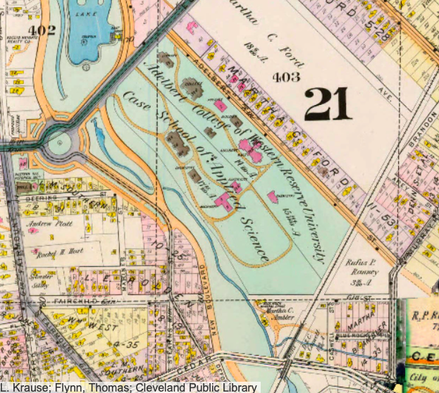
The street map from 1898 illustrates the neighboring campuses of Western Reserve University and Case School of Applied Science. They are bounded by Euclid Avenue and Adelbert (west and north) and by New Boulevard (later East and MLK) to the south. The campus spread further into surrounding University Circle spaces during the next 120 years | Date: 1898 | Source: https://www.arcgis.com/apps/View/index.html?appid=ddb0ee6134d64de4adaaa3660308abfd | Rights: USDA FSA, F.L. Krause; Flynn, Thomas; Cleveland Public Library.Download Original File