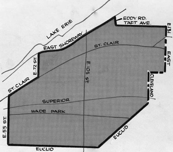
The image above depicts a map of the Glenville area cordoned off by the Cleveland Police Department following instances of rioting in the days following the shootout. Following the riots, the area cordoned off by police became associated with the violence that took place during the shootout. Due to this negative association, many residents that could afford to move out of the area did so while countless others who had formerly patronized Glenville's businesses began avoid the area, worsening the already present effects of urban decay. | Date: 1968 | Source: The Cleveland Memory ProjectDownload Original File