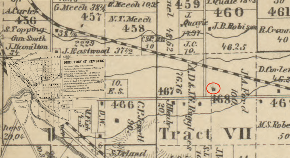
This segment of the 1858 Hopkins Map of Cuyahoga County shows the Bradford House (circled in red) fronting on the Cleveland and Chagrin Falls Plank Road (now Miles Avenue) and the Cleveland and Mahoning Railroad line running through the north part of Lot 468 upon which the house then stood. At the time the map was made, the John A. Ford family owned Lot 468. | Source: Cleveland Public Library, Digital Map CollectionDownload Original File