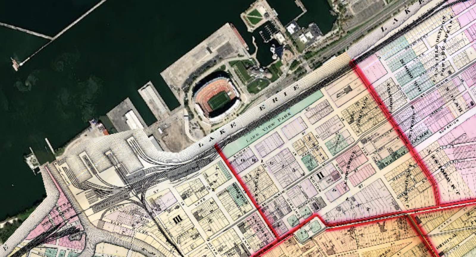
This composite map view shows how the present-day lakefront is well north of where the shore once stood thanks to "made land," or fill. Lake View Park appears in the 1874 map immediately south of the railroad tracks that separated it from Lake Erie. Note the old Union Passenger Depot immediately to the park's southwest. The park's slope (65 feet in height) enabled park goers to see the lake above the passing trains but did nothing to protect them from the pollution of the coal-burning locomotives and other toxins from nearby factories. | Date: 1874 | Source: Lake, D. J. Atlas of Cuyahoga County, Ohio, from Actual Surveys by and Under the Directions of D. J. Lake. Philadelphia: Titus, Simmons & Titus, 1874; satellite layer (via Cleveland Historic Maps)Download Original File
Source
Lake, D. J. Atlas of Cuyahoga County, Ohio, from Actual Surveys by and Under the Directions of D. J. Lake. Philadelphia: Titus, Simmons & Titus, 1874; satellite layer (via Cleveland Historic Maps)
Date
1874
"Composite of 1874 and Modern Maps" appears in: Lake View Park