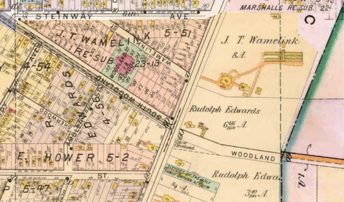
J. T. Wamelink Homestead and Subdivision, 1898 ID: 10977 | This file appears in: East End Neighborhood House This 1898 atlas map detail shows the triangular subdivision that Wamelink developed to the west of present-day Woodhill Road and the Wamelink homestead to the east. | Source: Cleveland Public Library Map Collection Download Original File SourceCleveland Public Library Map Collection "J. T. Wamelink Homestead and Subdivision, 1898" appears in: East End Neighborhood House