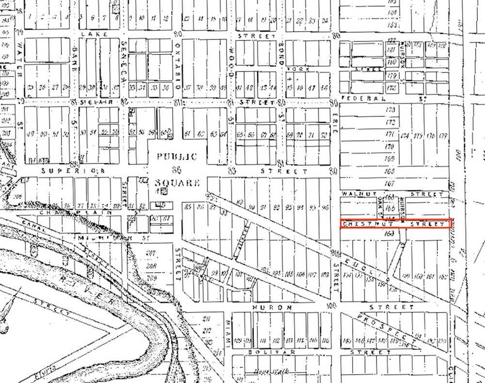
This section of the 1835 Ahaz Merchant map of Cleveland and its Environs shows Chestnut Street (in red) running from Erie Street (East Ninth Street) to the city's easter boundary at what is today East 13th Street. This section of the street continued to be called Chestnut until 1921 when an extension of Chester Avenue to the east connected the two streets and Chestnut Street became part of Chester Avenue. | Source: Cleveland State University, Michael Schwartz Library, Special CollectionsDownload Original File
Source
Cleveland State University, Michael Schwartz Library, Special Collections