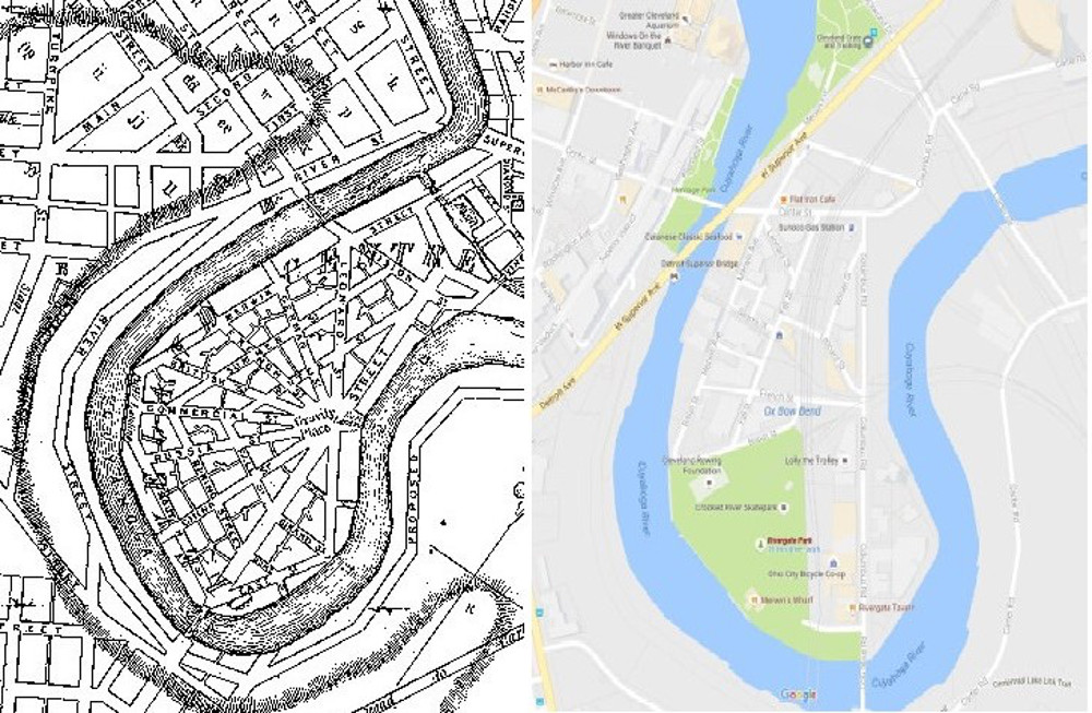
These two maps, the one on the left drawn by County Surveyor Ahaz Merchant in 1835, and the other one created by Google Maps 180 years later in 2015, give an idea of the changes that occurred at Cleveland Centre over this long period of time, not only to its radial street plan, but also to it land mass, which was reduced and re-shaped as a result of many government river channel projects. | Source: Cleveland Public Library, Digital Map Collection, and Google MapsDownload Original File
Source
Cleveland Public Library, Digital Map Collection, and Google Maps