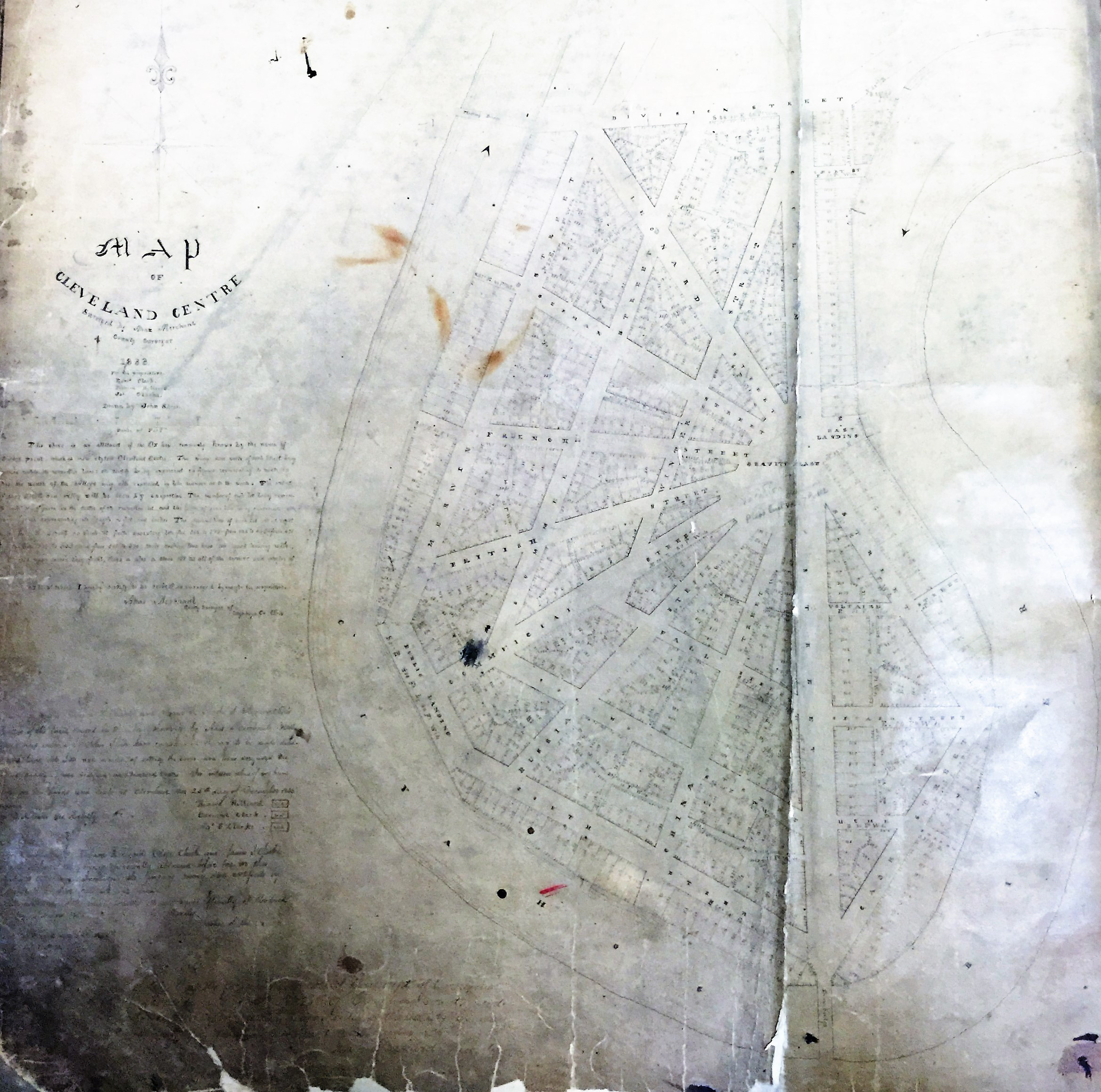
In 1833, developers James S. Clarke, Richard Hilliard and Edmund Clark submitted the above plat to the Cuyahoga County County Commissioners in order to obtain permission to sell lots in the village development they proposed for 50 acres of land on the east bank of the Cuyahoga River at Case's Point, now known as Ox Bow Bend or Columbus Road Peninsula. The plat shows the radial street plan they proposed, featuring a number of streets named after foreign countries emanating from a hub called Gravity Place. | Source: Cuyahoga County ArchivesDownload Original File